Elevation of Vairagwadi, Maharashtra, India
Location: India > Maharashtra > Kolhapur >
Longitude: 74.3624129
Latitude: 16.1508163
Elevation: 720m / 2362feet
Barometric Pressure: 93KPa
Elevation Map:
Satellite Map:
Related Photos:

My fnds

My fnds

Lecture on National Science Day at Nool, Kowad, Kolhapur for student & teachers. All Lectures since 26-02-2016 are organised by Marathi Vidnyan Parishad, Gadhinglaj

Lecture on National Science Day at Nool, Kowad, Kolhapur for student & teachers. All Lectures since 26-02-2016 are organised by Marathi Vidnyan Parishad, Gadhinglaj

Lecture on National Science Day at Nool, Kowad, Kolhapur for student & teachers. All Lectures since 26-02-2016 are organised by Marathi Vidnyan Parishad, Gadhinglaj

Lecture on National Science Day as Chief Guest for prize distribution at Gadhinglaj Nagarparishad. All Lectures since 26-02-2016 are organised by Marathi Vidnyan Parishad, Gadhinglaj

Lecture on National Science Day as Chief Guest for prize distribution at Gadhinglaj Nagarparishad. All Lectures since 26-02-2016 are organised by Marathi Vidnyan Parishad, Gadhinglaj
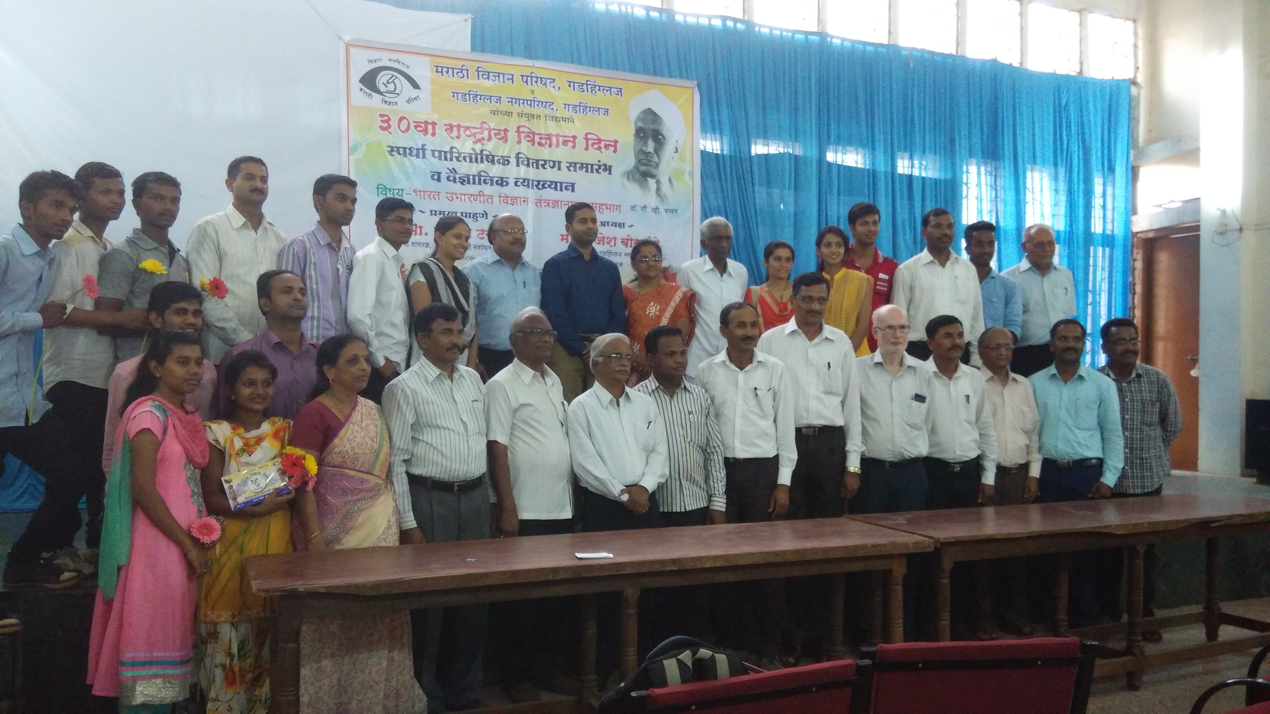
Lecture on National Science Day as Chief Guest for prize distribution at Gadhinglaj Nagarparishad. All Lectures since 26-02-2016 are organised by Marathi Vidnyan Parishad, Gadhinglaj

Lecture on National Science Day as Chief Guest for prize distribution at Gadhinglaj Nagarparishad. All Lectures since 26-02-2016 are organised by Marathi Vidnyan Parishad, Gadhinglaj

i5 snaps

i5 snaps

Driving from Bombay to Goa, September 2012

Mumbai to Goa, September 2012
Topographic Map of Vairagwadi, Maharashtra, India
Find elevation by address:

Places near Vairagwadi, Maharashtra, India:
Hasurwadi
Harli Kh.
S.s. Engineering & Fabrication
Mahagaon
Hasursasgiri
Umbarwadi
Chinchewadi
Harur
Gajargaon
Kadal
Hidadugi
Sule
Mangur Tarf Sawantwadi
Jambhulwadi
Batkanangale
Naukud
Kanoli
Patil Colony
Bhujang Patil Lane
Tupurwadi
Recent Searches:
- Elevation of Coan West, Coon West, Co. Kilkenny, Ireland
- Elevation of 8 Rue Raoul Dufy, Collioure, France
- Elevation of 6 Muir St, Medowie NSW, Australia
- Elevation of Woodland Road, Woodland Rd, Lee, MA, USA
- Elevation of Turner Mill Rd, Talladega, AL, USA
- Elevation of Wylie Ridge Rd, New Cumberland, WV, USA
- Elevation of Dogwood Ln, Millsboro, DE, USA
- Elevation of Paseo Lucido, San Diego, CA, USA
- Elevation of W S, Orem, UT, USA
- Elevation of Water Bird Wy, Punta Gorda, FL, USA