Elevation map of Uralla Shire Council, Uralla, NSW, Australia
Location: Australia > New South Wales >
Longitude: 151.233559
Latitude: -30.486483
Elevation: 756m / 2480feet
Barometric Pressure: 93KPa
Elevation Map:
Satellite Map:
Related Photos:
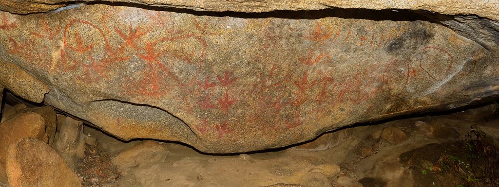
Yarrowyck Rock Art

Mount Yarrowyck

Rocky Smile

180422 NSW LD Saddleback
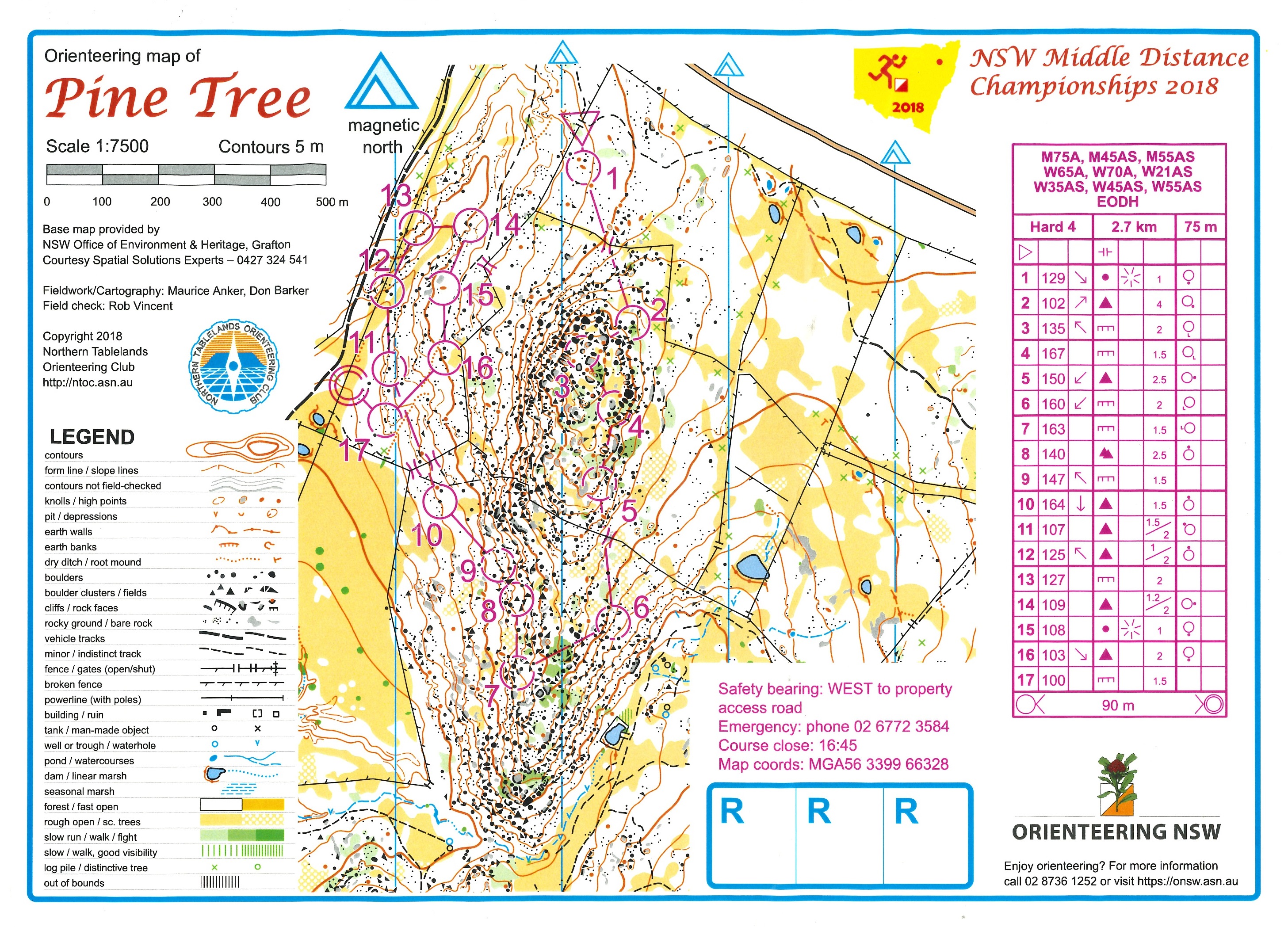
180421 NSW MD Pine Tree

130717_0658MtYarrowyckFromRiedsRoadLx.jpg

Bruce flying

Todd top out

Todd flying

Todd catching

Todd mantling the arete

Bruce's layback

Adidas rulez
Topographic Map of Uralla Shire Council, Uralla, NSW, Australia
Find elevation by address:

Places in Uralla Shire Council, Uralla, NSW, Australia:
Places near Uralla Shire Council, Uralla, NSW, Australia:
70 Kareela Rd
Invergowrie
Uralla
Hosanna Horizons
Briarbrook
540 Ramah Road
Dumaresq
Gunnalong Road
Gunnalong Road
Barraba Road
5 Highlands Rd
565 Eastern Ave
Bendemeer
Bonna
209 Clarks Rd
43 Garibaldi St
1 Back Woolbrook Rd
2 Reginald Ave
Armidale
275 Toms Gully Rd
Recent Searches:
- Elevation of Elwyn Dr, Roanoke Rapids, NC, USA
- Elevation of Congressional Dr, Stevensville, MD, USA
- Elevation of Bellview Rd, McLean, VA, USA
- Elevation of Stage Island Rd, Chatham, MA, USA
- Elevation of Shibuya Scramble Crossing, 21 Udagawacho, Shibuya City, Tokyo -, Japan
- Elevation of Jadagoniai, Kaunas District Municipality, Lithuania
- Elevation of Pagonija rock, Kranto 7-oji g. 8"N, Kaunas, Lithuania
- Elevation of Co Rd 87, Jamestown, CO, USA
- Elevation of Tenjo, Cundinamarca, Colombia
- Elevation of Côte-des-Neiges, Montreal, QC H4A 3J6, Canada