Elevation map of Tambacounda Region, Senegal
Location: Senegal >
Longitude: -13.174034
Latitude: 13.5619011
Elevation: 33m / 108feet
Barometric Pressure: 101KPa
Elevation Map:
Satellite Map:
Related Photos:

with the baobabs ...
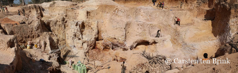
Among the "orpailleurs", the goldminers of the Kédougou region

Among the "orpailleurs", the goldminers of the Kédougou region

Passage House in Kolda, Senegal
Topographic Map of Tambacounda Region, Senegal
Find elevation by address:

Recent Searches:
- Elevation of Scenic Shore Dr, Kingwood Area, TX, USA
- Elevation of W Prive Cir, Delray Beach, FL, USA
- Elevation of S Layton Cir W, Layton, UT, USA
- Elevation of F36W+3M, Mussoorie, Uttarakhand, India
- Elevation of Fairland Ave, Fairhope, AL, USA
- Elevation of Sunset Dr, Richmond, VA, USA
- Elevation of Grodna District, Hrodna Region, Belarus
- Elevation of Hrodna, Hrodna Region, Belarus
- Elevation of Sandia Derby Estates, Tijeras, NM, USA
- Elevation of 23 Sunrise View Ct, Tijeras, NM, USA