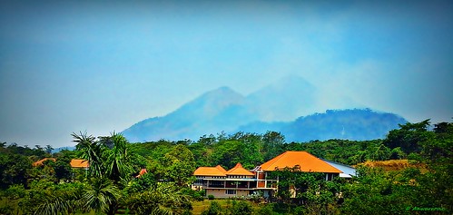
Elevation of Taman Pacet, Jl. Kartini No., Made, Pacet, Kec. Pacet, Mojokerto, Jawa Timur, Indonesia
Location: Indonesia > East Java > Mojokerto > Pacet > Pacet > Made >
Longitude: 112.537755
Latitude: -7.666863
Elevation: 650m / 2133feet
Barometric Pressure: 94KPa
Related Photos:
Topographic Map of Taman Pacet, Jl. Kartini No., Made, Pacet, Kec. Pacet, Mojokerto, Jawa Timur, Indonesia
Find elevation by address:

Places near Taman Pacet, Jl. Kartini No., Made, Pacet, Kec. Pacet, Mojokerto, Jawa Timur, Indonesia:
Pacet
Made
8gqr+r3j
Pacet
Trawas
Arjuno-welirang
Pecalukan
Mount Penanggungan
Hutan
Prigen
Gunung Arjuna
Bumiaji
Ngoro
Ngoro
Petung Sari
Kepiting Cak Gundul 1992
Petungasri
Prigen Safari Park
Jatiarjo
Bumiaji
Recent Searches:
- Elevation of Congressional Dr, Stevensville, MD, USA
- Elevation of Bellview Rd, McLean, VA, USA
- Elevation of Stage Island Rd, Chatham, MA, USA
- Elevation of Shibuya Scramble Crossing, 21 Udagawacho, Shibuya City, Tokyo -, Japan
- Elevation of Jadagoniai, Kaunas District Municipality, Lithuania
- Elevation of Pagonija rock, Kranto 7-oji g. 8"N, Kaunas, Lithuania
- Elevation of Co Rd 87, Jamestown, CO, USA
- Elevation of Tenjo, Cundinamarca, Colombia
- Elevation of Côte-des-Neiges, Montreal, QC H4A 3J6, Canada
- Elevation of Bobcat Dr, Helena, MT, USA


