Elevation of State Hwy, Pocahontas, AR, USA
Location: United States > Arkansas > Randolph County > Jackson Township >
Longitude: -91.049999
Latitude: 36.393505
Elevation: 133m / 436feet
Barometric Pressure: 100KPa
Elevation Map:
Satellite Map:
Related Photos:

Pawpaw is tuckered out. ????
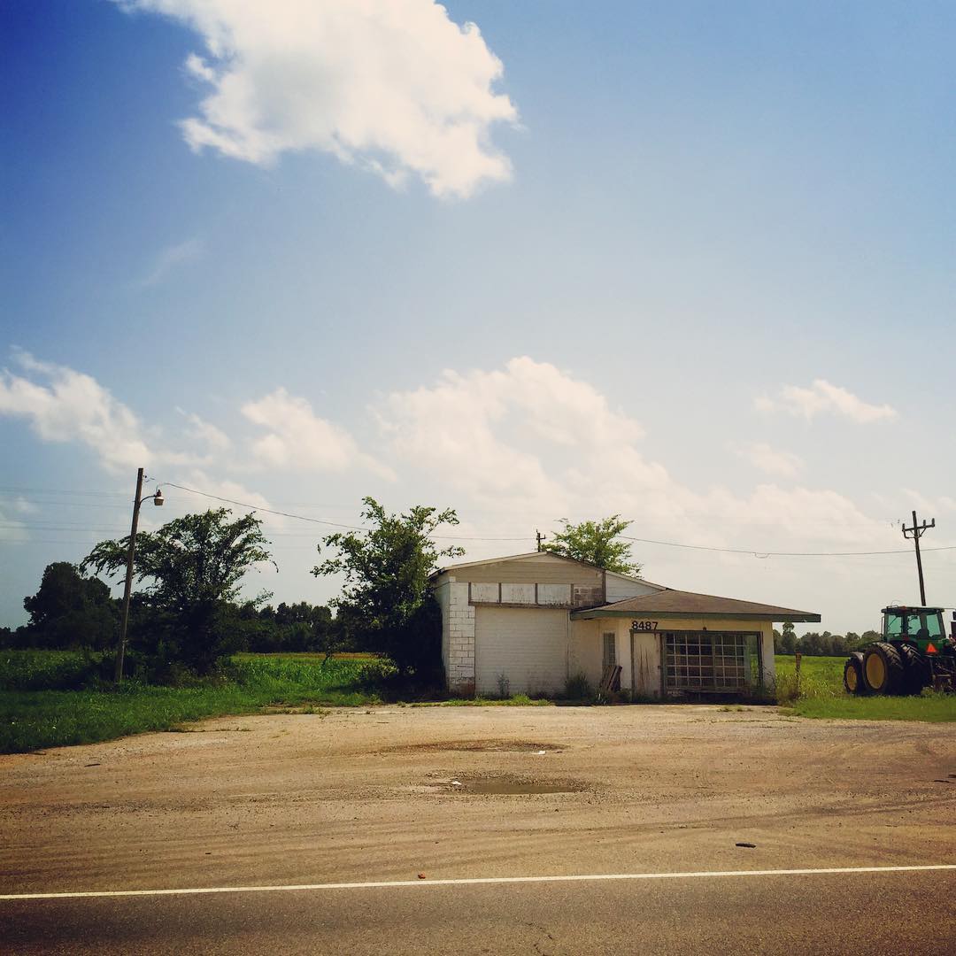
When I see places like this on the side of the road I can't help but get lost in my wondering...who used to be around here? Whose lives were changed here? What's the story? #nerd #dork #stuffiwonderabout #clouds #building #abandoned #arkansas #roadside

School bus

Eddie Mae Herron Center

Pocahontas, AR

Pocahontas, AR
Topographic Map of State Hwy, Pocahontas, AR, USA
Find elevation by address:

Places near State Hwy, Pocahontas, AR, USA:
Jackson Township
1345 Palestine Rd
Ingram Township
Warm Springs Township
Stoney Point Rd, Pocahontas, AR, USA
Shiloh Township
Randolph County
Warm Springs
Parkview, Warm Springs, AR, USA
Hwy 90 W, Ravenden Springs, AR, USA
State Hwy 93, Pocahontas, AR, USA
Warm Springs Rd, Warm Springs, AR, USA
Water Valley Township
Columbia Township
AR-, Pocahontas, AR, USA
Dalton Township
709 Carroll St
2002 W Pyburn St
Demun
West Roanoke Township
Recent Searches:
- Elevation of Gateway Blvd SE, Canton, OH, USA
- Elevation of East W.T. Harris Boulevard, E W.T. Harris Blvd, Charlotte, NC, USA
- Elevation of West Sugar Creek, Charlotte, NC, USA
- Elevation of Wayland, NY, USA
- Elevation of Steadfast Ct, Daphne, AL, USA
- Elevation of Lagasgasan, X+CQH, Tiaong, Quezon, Philippines
- Elevation of Rojo Ct, Atascadero, CA, USA
- Elevation of Flagstaff Drive, Flagstaff Dr, North Carolina, USA
- Elevation of Avery Ln, Lakeland, FL, USA
- Elevation of Woolwine, VA, USA