Elevation of S Red Robin Dr, Xenia, OH, USA

Location: United States > Ohio > Greene County > Beavercreek Township >

Longitude: -84.001352

Latitude: 39.7654724

Elevation: 257m / 843feet

Barometric Pressure: 98KPa

Elevation Map:

elevation map of S Red Robin Dr, Xenia, OH, USA

Satellite Map:

Satellite map of S Red Robin Dr, Xenia, OH, USA

Related Photos:

snow snowy snowcovered farm farmlands flat lonetree silhouette highcontrast minimal minimalist blackandwhite afh newjasper oh ohio p1000 coolpixp1000 nikoncoolpixp1000 wintry frosty january jennypansing winter
4785ex2 snowy farmlands
eastwoodmetropark earedgrebe dayton ohio montgomerycounty
EARED GREBE
winter sunset ohio urban window decay gritty dirty filthy crusty dayton patina grungy instamatic frontstreet digitography
window view #4
north american b25 naa mithchell
Doolittle Raid Reunion B-25 Gathering
ohio museum airplane aircraft fisheye c17 globemaster airforce dayton photomatix nationalmuseumoftheairforce theaterwiz theaterwizphotography michaelcriswell canon815f4l
Globemaster III
christmas peanuts christmastree linus ornaments blanket charliebrown charlesschultz
Ornamental View
tracyhall flagged trackhead trackheadstudios trackheadxxx adamhall halloween mask scary spooky
It Sleeps Next To Me Nightly
wood ohio red graffiti pedestrian hidden coveredbridge hdr yellowsprings cemetaryroad howetruss glenhellen
Hidden Bridge in the Glen | Yellow Springs, Ohio
ohio chevrolet hardtop 1969 turn mall shopping easter town spring gm view suburban outdoor weekend rear indoor center right chevelle malibu chevy bumper chrome lane april beavercreek suburb guards left coupe dayton 2012 abody generalmotors intermediate 2door i675 threequarter thegreene worldcars
Back Off
national museum usaf force aircraft aviation aeroplane wright patterson dayton ohio usa us mcdonnell douglas x36 air johnny comstedt
McDonnell Douglas (Boeing) X-36 at Wright-Patterson
winter ohio bw film window train blackwhite urbandecay dayton decayed thirdfloor printscan kodaktechpan
Passing Train
ohio brick ivy textures doorway abandonded hdr yellowsprings rustydoor oldantiochtheatre
Please, Step On In | Yellow Springs, Ohio
p80 f80 jet nmusaf usaf lockheed dayton
XP-80R Shooting Star at Dayton
libraries archives daytonohio historicphotographs mcpf1671 montgomerycountypicturefile
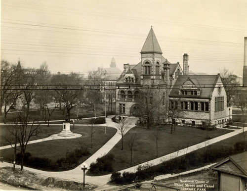
Dayton Public Library, Old Main Library
ohio archives dayton ohiohistory historicphotographs daytonmetrolibrary 1913flood montgomerycountypicturefile greatdaytonflood mcpf0934 1913after 1913during
National Cash Register, Dayton, OH - 1913 Flood
seversky p35 nmusaf dayton usaac
Seversky P-35 at Air Force Museum
archives daytonohio ohiohistory historicphotographs daytonmetrolibrary 1913flood 1913floodpostcardscollection greatdaytonflood flp203b1 1913during
Section of Flooded District, Dayton, OH - 1913 Flood
vintageaircraft militarytransport antiqueaircraft preservedaircraft beechd18s beechc45hexpeditor classicpropliner 5210893
Beech C-45H Expeditor (52-10893)
ohio archives dayton ohiohistory historicphotographs daytonmetrolibrary 1913flood montgomerycountypicturefile greatdaytonflood 1913after mcpf1104 1913during
Delco Factory, Dayton, OH - 1913 Flood
What Once Was.
blackandwhite bw monochrome mono 2000 boeing usairforce airforcemuseum stratocruiser exusaf kc97l ohioairguard 522630 wrightpattersen
'Led sled'
Yellow Springs, Ohio
statepark longexposure ohio nature wet water leaves rock stone landscape flow waterfall leaf moss maple whitewater stream smooth fallen gorge clifton narrows yellowsprings littlemiamiriver cliftongorge johnbryanstatepark neutraldensity easterncottonwood fallsofthelittlemiami
Together At Last
bridge trees ohio water creek river waterfall log oasis soe yellowsprings glenhellen
Oasis in the Glen | Yellow Springs, Ohio
clarkecounty clifton cliftongorge greenecounty ohio river snp littlemiamiriver
The Little Miami At Clifton
square squareformat iphoneography instagramapp uploaded:by=instagram foursquare:venue=4b0c3faff964a520b93923e3
St. Mary's Institute Steps in St. Mary's Hall #stmaryshall #ud #udayton #universityofdayton #steps #campus #building #Dayton
yellowspringsohio glenhelennaturepreserve
The Bridge is Out
djiphantom4pro dayton downtown downtowndayton ohio ushighway35 usroute35 aerial aerialphotography drone highway interchange unitedstates us
U.S. Route 35
postcard banksy extras oilpainting mbw mrbrainwash thierryguetta exitthroughthegiftshop
Landscape with Inmate
sunset field sunflowers sunflower yellowsprings greenecounty us68 ruralohio geotaggedohio tecumsehlandtrust
Sunflowers in Yellow Springs
ohio dayton
Layers of Natural Reality
dayton ohio huffmanprairieflyingfield
Sunrise on the Prairie
dayton ohio huffmanprairieflyingfield
Tall Grass in High Summer (Landscape)
statepark longexposure ohio nature wet water leaves rock stone landscape flow us waterfall leaf moss maple whitewater stream unitedstates smooth fallen gorge liquid clifton narrows yellowsprings solid littlemiamiriver cliftongorge johnbryanstatepark neutraldensity easterncottonwood fallsofthelittlemiami
Falls Of The Little Miami
leaves path driveway gated paved
Road Well Traveled
naturesvistaphotography landscapephotography naturephotography ruralphotography travelphotography
Autumn Woods
farm farming rural ohiofoothills ohio yellowsprings phantom3 drone quadcopter
Sunflower Field in Yellow Springs Ohio
trees snow landscape hdr fairborn communitypark fairbornohio fairbornoh byalexsablan
First Snow
ohio bird dayton wrightbrothers americankestrel wrightpattersonairforcebase huffmanprairieflyingfield
American Kestrel
dayton ohio huffmanprairieflyingfield wrightpattersonafb bobolink
Female Bobolink?
street abandoned fire district 4 historic east ashes burnt fourth dayton burned iphone huffman durrum
After the fire on E. Fourth
ohio bird dayton wrightbrothers americankestrel wrightpattersonairforcebase huffmanprairieflyingfield
American Kestrel