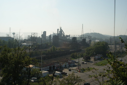
Elevation of S Commerce Dr, Ashland, KY, USA
Location: United States > Kentucky > Boyd County > Ashland >
Longitude: -82.789734
Latitude: 38.4016059
Elevation: 258m / 846feet
Barometric Pressure: 98KPa
Related Photos:
Topographic Map of S Commerce Dr, Ashland, KY, USA
Find elevation by address:

Places near S Commerce Dr, Ashland, KY, USA:
Brush Creek Rd, Argillite, KY, USA
134 Homestead Dr
3310 Culp Creek Rd
Heritage Heights Rd, Ashland, KY, USA
Argillite
Boyd County
Tiffany Dr, Ashland, KY, USA
220 Jane Hill Rd
3154 May St
Westwood
Altamont Drive
2727 Monroe St
1000 Greenup Ave
133 Reatta St
408 Indian Hills Rd
Ashland
Ashland
17th St, Ashland, KY, USA
Grayson
Recent Searches:
- Elevation of Woolwine, VA, USA
- Elevation of Lumagwas Diversified Farmers Multi-Purpose Cooperative, Lumagwas, Adtuyon, RV32+MH7, Pangantucan, Bukidnon, Philippines
- Elevation of Homestead Ridge, New Braunfels, TX, USA
- Elevation of Orchard Road, Orchard Rd, Marlborough, NY, USA
- Elevation of 12 Hutchinson Woods Dr, Fletcher, NC, USA
- Elevation of Holloway Ave, San Francisco, CA, USA
- Elevation of Norfolk, NY, USA
- Elevation of - San Marcos Pass Rd, Santa Barbara, CA, USA
- Elevation of th Pl SE, Issaquah, WA, USA
- Elevation of 82- D Rd, Captain Cook, HI, USA


