Elevation of Rajapurwadi, Karnataka, India
Location: India > Karnataka > Belagavi >
Longitude: 74.6590728
Latitude: 16.6073341
Elevation: 540m / 1772feet
Barometric Pressure: 95KPa
Elevation Map:
Satellite Map:
Related Photos:

Fierce. Strength. Unstoppable. #throughmysisterseyes #doodhsagar #doodhsagarfalls #goa #instagrammers #igers #instalove #instamood #instagood #iphoneography #instadaily #igaddict

Image acquired by Sentinel-2A on 2019 January 30 at 5:44 UTC. Centre coordinates: 16.69 N, 74.58 E.

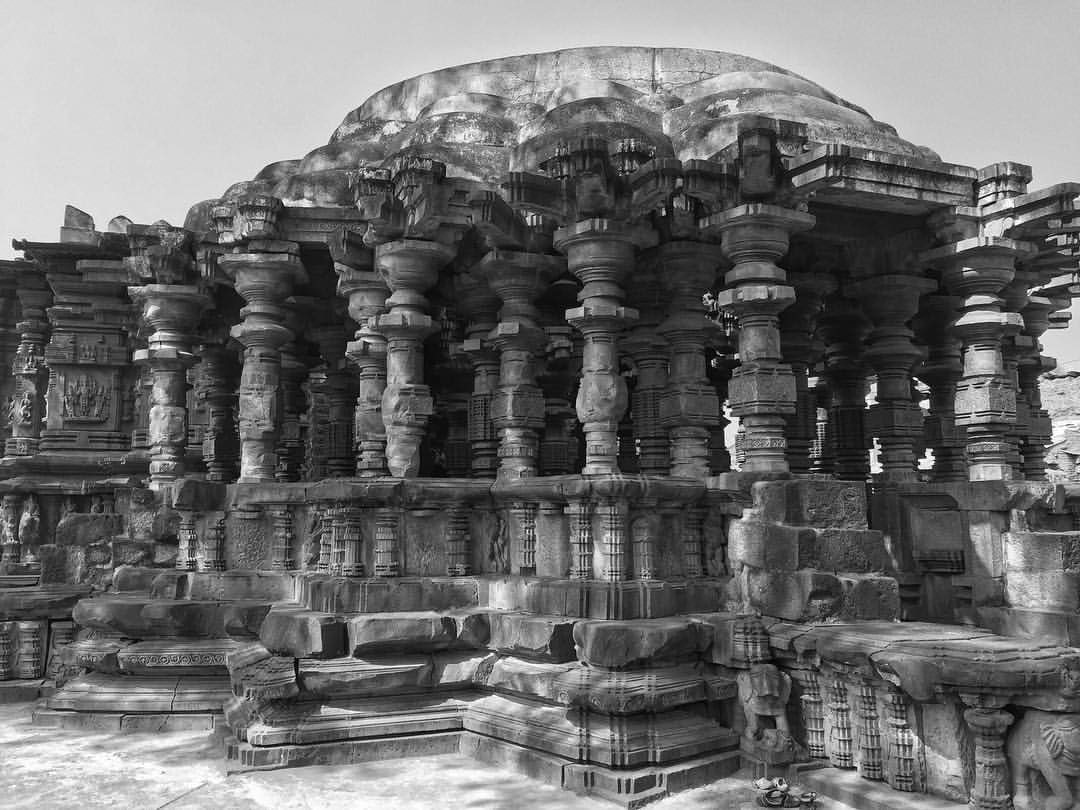
Kopeshwar Temple,Khidrapur

Khidrapur Temple

Kopeshwar Temple, Khidrapur
Khidrapur temple #ancient #temple #Hinduism #architecture #khidrapur #india #iphone #hdr
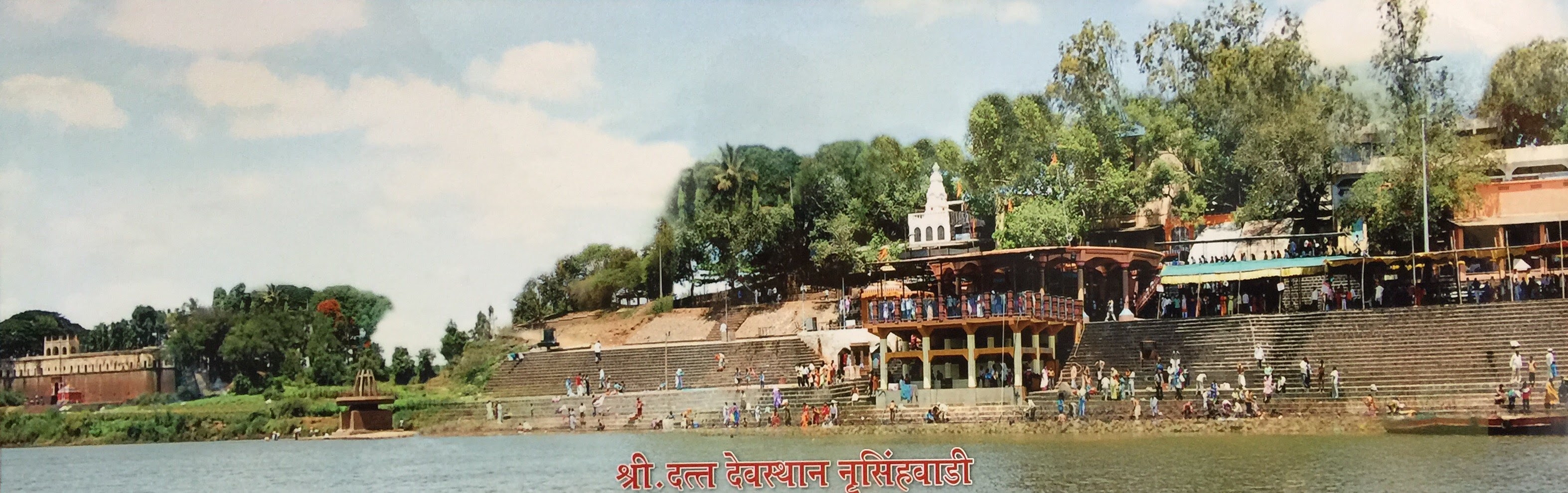
कणेरी मठ, पेठचा गणपती, जोतिबा, नरसोबाची वाडी, महालक्ष्मी कोल्हापूर.
कणेरी मठ, पेठचा गणपती, जोतिबा, नरसोबाची वाडी, महालक्ष्मी कोल्हापूर.

कणेरी मठ, पेठचा गणपती, जोतिबा, नरसोबाची वाडी, महालक्ष्मी कोल्हापूर.

कणेरी मठ, पेठचा गणपती, जोतिबा, नरसोबाची वाडी, महालक्ष्मी कोल्हापूर.

कणेरी मठ, पेठचा गणपती, जोतिबा, नरसोबाची वाडी, महालक्ष्मी कोल्हापूर.
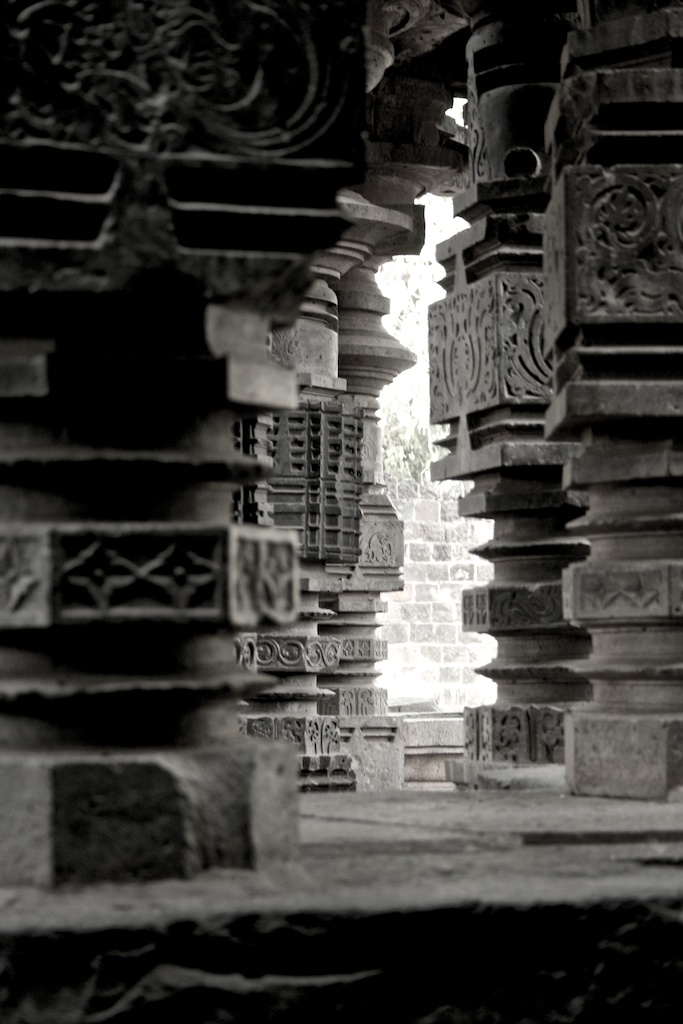
4125: Khidrapur Temple Columns

@Panchaganga

@Panchaganga
Topographic Map of Rajapurwadi, Karnataka, India
Find elevation by address:

Places near Rajapurwadi, Karnataka, India:
Khidrapur
Bubnal
Dattawad
Kurundwad
Narsoba Chi Wadi Mandir
Nrusinhawadi
Narasoba Wadi
Ganeshwadi
Hasur
Raibag
Nandani
Haroli
Arjunwad
Chikodi
Primary School Nagargojewadi
Jaysingpur
Patil Vasati
Bolwad
Rajiv Gandhi Nagar
Miraj
Recent Searches:
- Elevation of Congressional Dr, Stevensville, MD, USA
- Elevation of Bellview Rd, McLean, VA, USA
- Elevation of Stage Island Rd, Chatham, MA, USA
- Elevation of Shibuya Scramble Crossing, 21 Udagawacho, Shibuya City, Tokyo -, Japan
- Elevation of Jadagoniai, Kaunas District Municipality, Lithuania
- Elevation of Pagonija rock, Kranto 7-oji g. 8"N, Kaunas, Lithuania
- Elevation of Co Rd 87, Jamestown, CO, USA
- Elevation of Tenjo, Cundinamarca, Colombia
- Elevation of Côte-des-Neiges, Montreal, QC H4A 3J6, Canada
- Elevation of Bobcat Dr, Helena, MT, USA