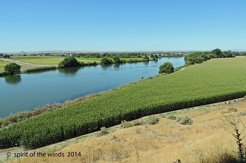
Elevation of Ontario Heights Rd, Ontario, OR, USA
Location: United States > Oregon > Malheur County > Ontario >
Longitude: -117.02167
Latitude: 44.070729
Elevation: 715m / 2346feet
Barometric Pressure: 93KPa
Related Photos:
Topographic Map of Ontario Heights Rd, Ontario, OR, USA
Find elevation by address:

Places near Ontario Heights Rd, Ontario, OR, USA:
2317 Nw 11th St
4655 Hyline Rd
57 Nw 16th St
Idaho Elks Hearing And Balance Center: Ontario
517 Sw 2nd St
Ontario
Southeast 1st Avenue
1120 N 6th St
Payette
Onion Ave, Ontario, OR, USA
Manser Dr, Payette, ID, USA
Ramey
NW 16th St, Fruitland, ID, USA
River Rd, Payette, ID, USA
1273 Spring Creek Ln
602 W 1st St
SW 4th St, Fruitland, ID, USA
Fruitland
Southwest Avenue
Elm St, New Plymouth, ID, USA
Recent Searches:
- Elevation of Zimmer Trail, Pennsylvania, USA
- Elevation of 87 Kilmartin Ave, Bristol, CT, USA
- Elevation of Honghe National Nature Reserve, QP95+PJP, Tongjiang, Heilongjiang, Jiamusi, Heilongjiang, China
- Elevation of Hercules Dr, Colorado Springs, CO, USA
- Elevation of Szlak pieszy czarny, Poland
- Elevation of Griffing Blvd, Biscayne Park, FL, USA
- Elevation of Kreuzburger Weg 13, Düsseldorf, Germany
- Elevation of Gateway Blvd SE, Canton, OH, USA
- Elevation of East W.T. Harris Boulevard, E W.T. Harris Blvd, Charlotte, NC, USA
- Elevation of West Sugar Creek, Charlotte, NC, USA


