Elevation of Ninh Sơn District, Ninh Thuan Province, Vietnam
Location: Vietnam >
Longitude: 108.736337
Latitude: 11.6888699
Elevation: 136m / 446feet
Barometric Pressure: 100KPa
Elevation Map:
Satellite Map:
Related Photos:

Quốc Phong - Trang trại

Quốc Phong - Trang trại

Quốc Phong - Trang trại

Quốc Phong - Trang trại

-c20160527_810_8991

Rainy Day

Quốc Phong - Trang trại

Quốc Phong - Trang trại

Quốc Phong - Trang trại

Quốc Phong - Trang trại

Quốc Phong - Trang trại

Quốc Phong - Trang trại

Quốc Phong - Trang trại

My team

My team

c20160126_810_7730-Edit

c20160126_810_7723-Edit
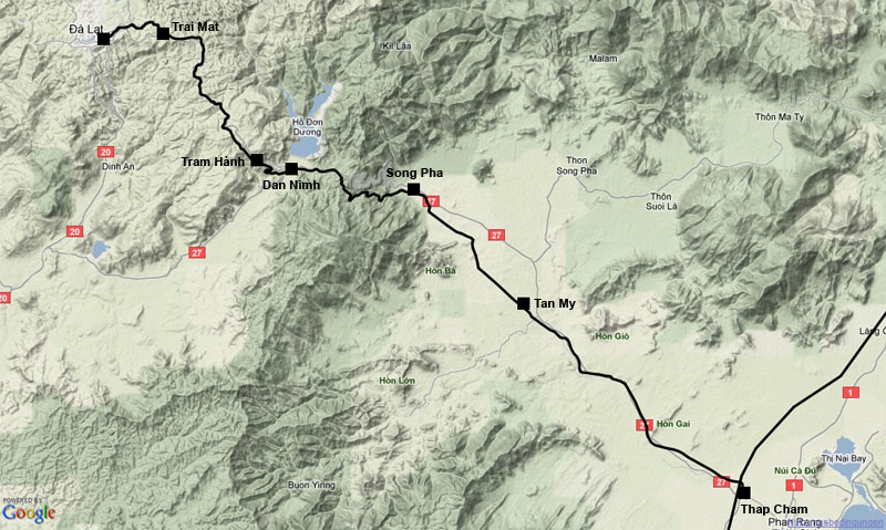
Map showing former railway line from Thap Cham to Da Lat
Topographic Map of Ninh Sơn District, Ninh Thuan Province, Vietnam
Find elevation by address:

Places near Ninh Sơn District, Ninh Thuan Province, Vietnam:
Ninh Thuan Province
D'ran
Phan Rang–tháp Chàm
Công Ty Cổ Phần Chăn Nuôi C.p. Việt Nam - Cn Ninh Thuận
Dalat
Chợ Đà Lạt
Đức Trọng District
Tà Nung
Lang Biang Peak
Cam Ranh
Khánh Vĩnh District
Khánh Hòa
Khanh Hoa Province
Diamond Bay Resort & Spa In Nha Trang City
Vĩnh Thái
60 Trần Phú
Nha Trang
34 Trần Phú
Recent Searches:
- Elevation of Crocker Dr, Vacaville, CA, USA
- Elevation of Pu Ngaol Community Meeting Hall, HWHM+3X7, Krong Saen Monourom, Cambodia
- Elevation of Royal Ontario Museum, Queens Park, Toronto, ON M5S 2C6, Canada
- Elevation of Groblershoop, South Africa
- Elevation of Power Generation Enterprises | Industrial Diesel Generators, Oak Ave, Canyon Country, CA, USA
- Elevation of Chesaw Rd, Oroville, WA, USA
- Elevation of N, Mt Pleasant, UT, USA
- Elevation of 6 Rue Jules Ferry, Beausoleil, France
- Elevation of Sattva Horizon, 4JC6+G9P, Vinayak Nagar, Kattigenahalli, Bengaluru, Karnataka, India
- Elevation of Great Brook Sports, Gold Star Hwy, Groton, CT, USA