Elevation of Nanthala Ct E, Hertford, NC, USA
Location: United States > North Carolina > Perquimans County > Hertford > Hertford >
Longitude: -76.397843
Latitude: 36.097843
Elevation: 3m / 10feet
Barometric Pressure: 101KPa
Elevation Map:
Satellite Map:
Related Photos:

Old Dollar General Building (Hertford; now possibly an auction location)
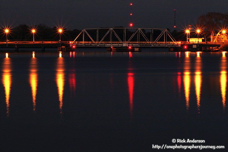
"S" Bridge - Hertford, North Carolina

2852 Hertford National Register of Historic Places Img_17446

marsh views abound

The view off the 18th @SGLatAP. Nice breeze from the water. Great finishing hole. @eGolfProTour1. #nencsports

Albemarle Sunset 83

March 2007 - Vacation, Day 8: Newbold-White Plantation

March 2007 - Vacation, Day 8: Newbold-White Plantation

2903 Hertfords S Shaped Bridge Img_17497

cows welcome new calves

On the road again ...

South Port NC
Topographic Map of Nanthala Ct E, Hertford, NC, USA
Find elevation by address:

Places near Nanthala Ct E, Hertford, NC, USA:
125 Pee Dee Dr
121 Shenandoah River Dr
Franks Creek Drive
398 Albemarle Blvd
Bethel
174 Clipper Dr
260 Churchs Ln
109 Driftwood Rd
122 Creek Trail
475 Goose Nest Ln
Perquimans County
114 Osprey Dr
102 Osprey Ln
101 Osprey Dr
99 Pelican Ct
101 Pelican Ct
120 Osprey Ln
125 Dogwood Dr
109 Pelican Ct
4 Dogwood Dr
Recent Searches:
- Elevation of Shibuya Scramble Crossing, 21 Udagawacho, Shibuya City, Tokyo -, Japan
- Elevation of Jadagoniai, Kaunas District Municipality, Lithuania
- Elevation of Pagonija rock, Kranto 7-oji g. 8"N, Kaunas, Lithuania
- Elevation of Co Rd 87, Jamestown, CO, USA
- Elevation of Tenjo, Cundinamarca, Colombia
- Elevation of Côte-des-Neiges, Montreal, QC H4A 3J6, Canada
- Elevation of Bobcat Dr, Helena, MT, USA
- Elevation of Zu den Ihlowbergen, Althüttendorf, Germany
- Elevation of Badaber, Peshawar, Khyber Pakhtunkhwa, Pakistan
- Elevation of SE Heron Loop, Lincoln City, OR, USA