Elevation of Muramba, Burundi
Location: Burundi > Muyinga > Buhinvuza >
Longitude: 30.3594043
Latitude: -2.9351936
Elevation: 1439m / 4721feet
Barometric Pressure: 85KPa
Elevation Map:
Satellite Map:
Related Photos:
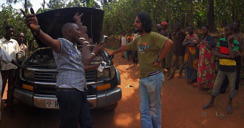
Just one more Burundi breakdown ...or another opportunity for an impromptu community meeting! #burundi #muyinga
Topographic Map of Muramba, Burundi
Find elevation by address:

Places near Muramba, Burundi:
Buhinvuza
Cankuzo
Cankuzo
Cankuzo
Bugenyuzi
Burundi
Kibondo
Muramvya
Kibira Park Lodge
Bugarama
Mumigunga
Nyarugusu Refugee Camp Kigoma
Recent Searches:
- Elevation of Unnamed Road, Respublika Severnaya Osetiya — Alaniya, Russia
- Elevation of Verkhny Fiagdon, North Ossetia–Alania Republic, Russia
- Elevation of F. Viola Hiway, San Rafael, Bulacan, Philippines
- Elevation of Herbage Dr, Gulfport, MS, USA
- Elevation of Lilac Cir, Haldimand, ON N3W 2G9, Canada
- Elevation of Harrod Branch Road, Harrod Branch Rd, Kentucky, USA
- Elevation of Wyndham Grand Barbados Sam Lords Castle All Inclusive Resort, End of Belair Road, Long Bay, Bridgetown Barbados
- Elevation of Iga Trl, Maggie Valley, NC, USA
- Elevation of N Co Rd 31D, Loveland, CO, USA
- Elevation of Lindever Ln, Palmetto, FL, USA