Elevation of Merrick Way, Abingdon, MD, USA
Location: United States > Maryland > Harford County > 1, Abingdon > Abingdon >
Longitude: -76.309203
Latitude: 39.4840897
Elevation: 67m / 220feet
Barometric Pressure: 101KPa
Elevation Map:
Satellite Map:
Related Photos:

1985 06-23 0922 Chessie System GP40-4094 E/B Belcamp, MD

1988 09-11 1100 Conrail C32-8-6616 E/B PYSE White Marsh, MD
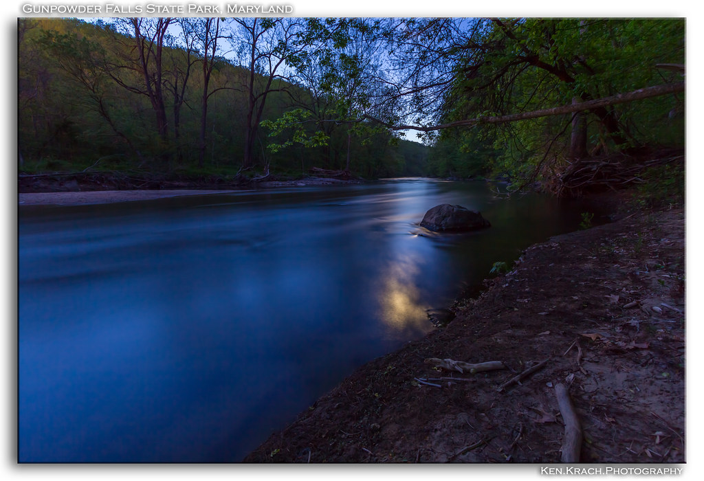
By the Dawns Early Moonlight (Updated)

My Window Needs Cleaning

Diesels on the Corridor
US MD Harford County - Noble's Mill Road view

Gunpowder 3-9-13 (4)

Royal Blue Route

The view Ahead

Cotton Candy

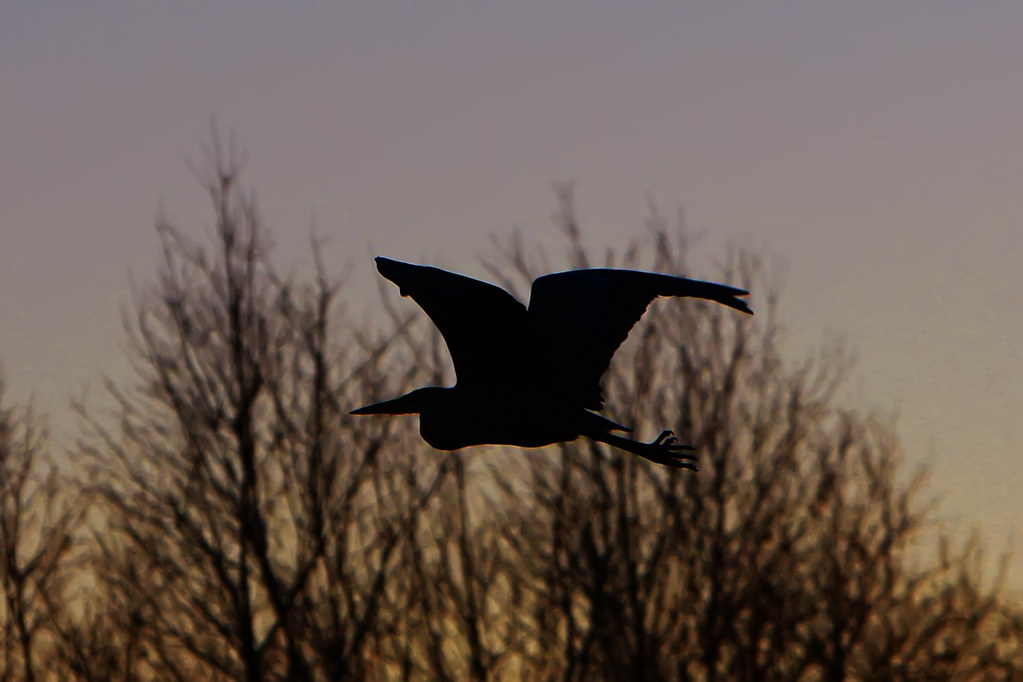
Orange sunset

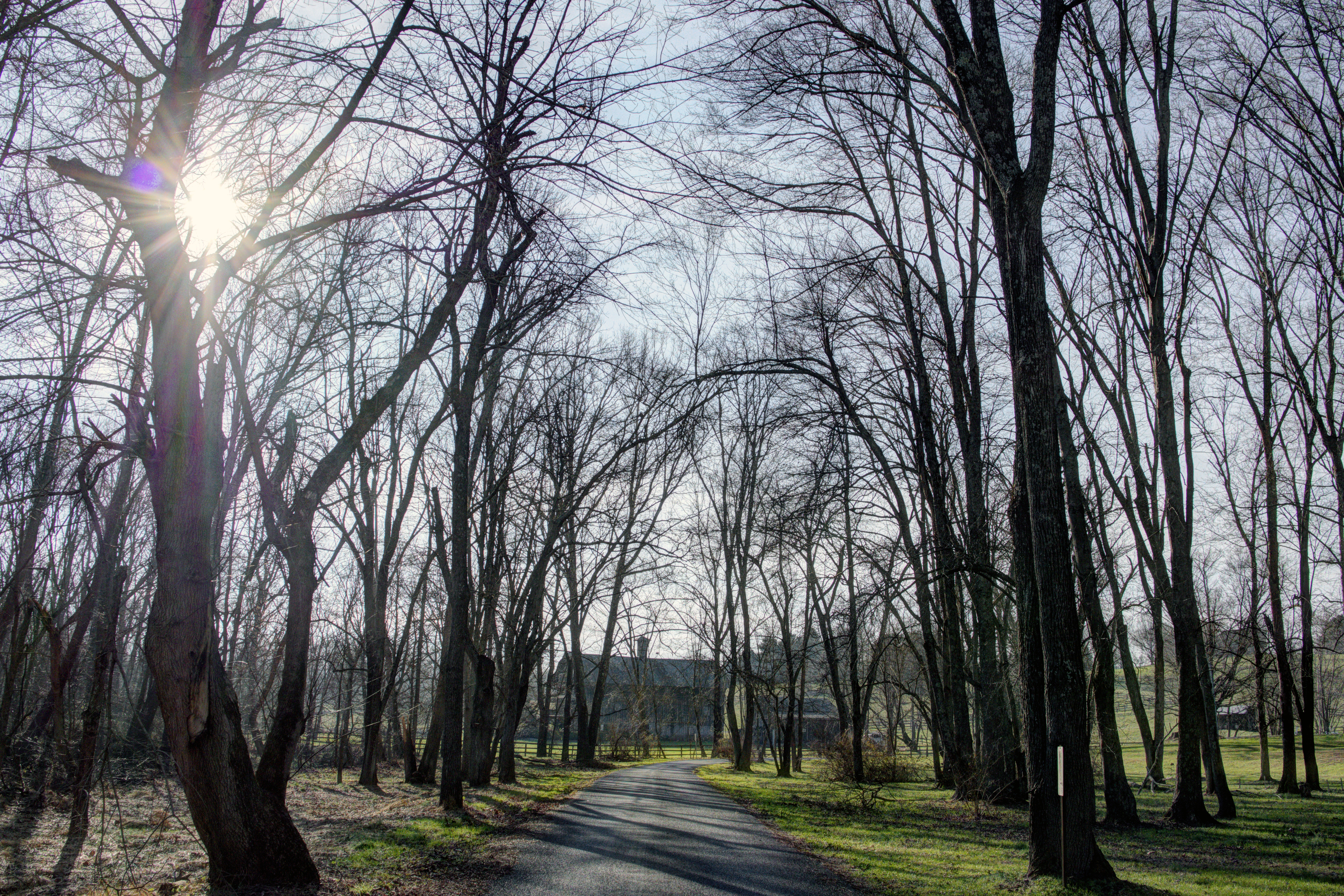
Jerusalem Mill Village ~ porch view
I Wandered Through My Playing Cards

US MD Baltimore County - Little Gunpowder Falls view from Franklinville Rd Bridge

Jerusalem Mill Village

Trackside Home

Under the Shelf

Golden Bank
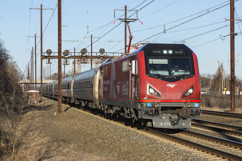
2019-12-19 1523 Amtrak 606 on 171, Perryman, MD

Amongst Us

2018 01-17 1040 MARC SC44-80, 81 N/B 802 Test, Middle River, MD
Late Winter Afternoon

Fall On The Gunpowder River

Dundee Creek

After The Storm

Vinegar Hill Road

Gunpowder Falls

Sunny Morning?

US MD Hydes - Long Green Creek
Early Winter Salt Marsh

Dwelling Place

Fall In The Air

1492-031 Ice

First Light of 2016

Swamped Forest

Sky Shot

Shelf cloud

Unhappy Little Clouds

Sunrise Shadows

Lots of Green
Topographic Map of Merrick Way, Abingdon, MD, USA
Find elevation by address:

Places near Merrick Way, Abingdon, MD, USA:
2627 Laurel Valley Garth
Box Hill Pizzeria
327 Clyde Ct
Spruce Pine Road
436 Abbey Cir
430 Abbey Cir
428 Abbey Cir
Laurel Bush Rd, Abingdon, MD, USA
3207 Arbor Hill Ct
Old Emmorton Rd, Bel Air, MD, USA
Pets In The Classroom
2217 Erin Way
611 Nanticoke Ct
629 Stone Mill Ct
Denton Ct, Abingdon, MD, USA
Golden Oak Ct, Bel Air, MD, USA
201 Rolling Knoll Dr
Rolling Rd, Bel Air, MD, USA
Bel Air South
Winding Valley Dr, Joppa, MD, USA
Recent Searches:
- Elevation of SW 57th Ave, Portland, OR, USA
- Elevation of Crocker Dr, Vacaville, CA, USA
- Elevation of Pu Ngaol Community Meeting Hall, HWHM+3X7, Krong Saen Monourom, Cambodia
- Elevation of Royal Ontario Museum, Queens Park, Toronto, ON M5S 2C6, Canada
- Elevation of Groblershoop, South Africa
- Elevation of Power Generation Enterprises | Industrial Diesel Generators, Oak Ave, Canyon Country, CA, USA
- Elevation of Chesaw Rd, Oroville, WA, USA
- Elevation of N, Mt Pleasant, UT, USA
- Elevation of 6 Rue Jules Ferry, Beausoleil, France
- Elevation of Sattva Horizon, 4JC6+G9P, Vinayak Nagar, Kattigenahalli, Bengaluru, Karnataka, India