Elevation of Little Salty Ct, Springtown, TX, USA
Location: United States > Texas > Parker County > Springtown >
Longitude: -97.814818
Latitude: 32.9989268
Elevation: 356m / 1168feet
Barometric Pressure: 97KPa
Elevation Map:
Satellite Map:
Related Photos:

Howard Ranch Entrance 2013

Texas Sunset

Veal Station Cemetery 4, Veal Station, Texas

Sunday ride

Dinosaur tooth?

Dinosaur footprints

Ghost town of Carterville Texas
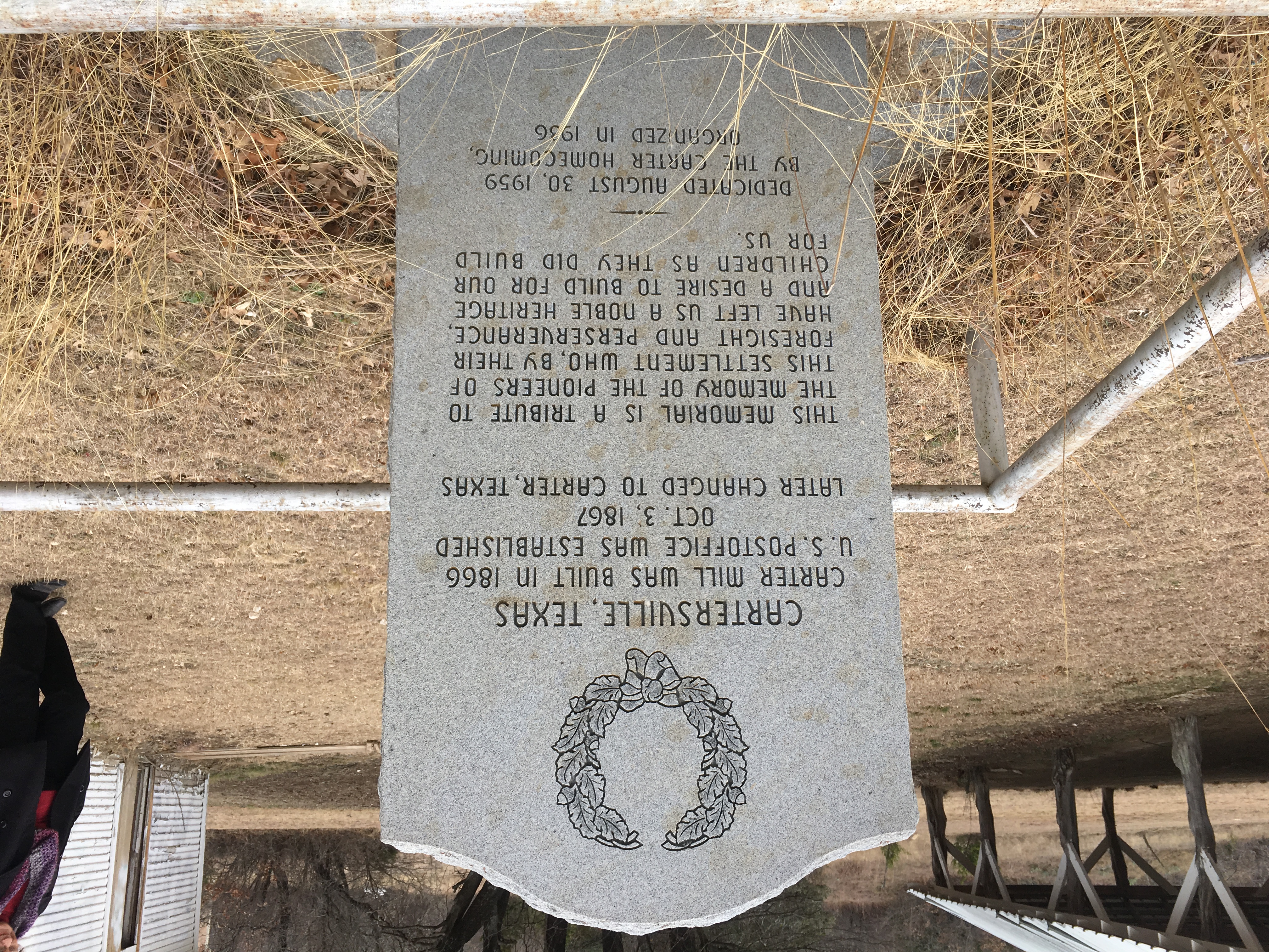
Ghost town of Carterville Texas

Ghost town of Carterville Texas

Ghost town of Carterville Texas

Ghost town of Carterville Texas

Ghost town of Carterville Texas

favorite spot in Springtown, TX

Texas-sized windmills. #BigBend #MountainAdventure2015

Family kids and grandkids

Family kids and grandkids

All Photos-19

All Photos-18

October Jane Freeman

October Jane Freeman

October Jane Freeman

October Jane Freeman

October Jane Freeman

October Jane Freeman
Topographic Map of Little Salty Ct, Springtown, TX, USA
Find elevation by address:

Places near Little Salty Ct, Springtown, TX, USA:
105 Salt Of The Earth Ct
Poolville
3981 W Hwy 199
111 Creek Bend Dr
208 Creek Bend Dr
6180 Zion Hill Rd
221 Creek Bend Dr
129 Mineral Springs Ct
Slipdown Mountain
161 Blue Sky Ln
146 Chapman Ranch Rd
Co Rd, Paradise, TX, USA
Jordan
1302 N Main St
Springtown
693 Co Rd 3525
693 Co Rd 3525
FM, Poolville, TX, USA
409 Sandpiper Dr
FM, Bridgeport, TX, USA
Recent Searches:
- Elevation of Congressional Dr, Stevensville, MD, USA
- Elevation of Bellview Rd, McLean, VA, USA
- Elevation of Stage Island Rd, Chatham, MA, USA
- Elevation of Shibuya Scramble Crossing, 21 Udagawacho, Shibuya City, Tokyo -, Japan
- Elevation of Jadagoniai, Kaunas District Municipality, Lithuania
- Elevation of Pagonija rock, Kranto 7-oji g. 8"N, Kaunas, Lithuania
- Elevation of Co Rd 87, Jamestown, CO, USA
- Elevation of Tenjo, Cundinamarca, Colombia
- Elevation of Côte-des-Neiges, Montreal, QC H4A 3J6, Canada
- Elevation of Bobcat Dr, Helena, MT, USA