Elevation of LA-, Maurice, LA, USA
Location: United States > Louisiana > Vermilion Parish > > Maurice >
Longitude: -92.179439
Latitude: 30.0432258
Elevation: 5m / 16feet
Barometric Pressure: 101KPa
Elevation Map:
Satellite Map:
Related Photos:
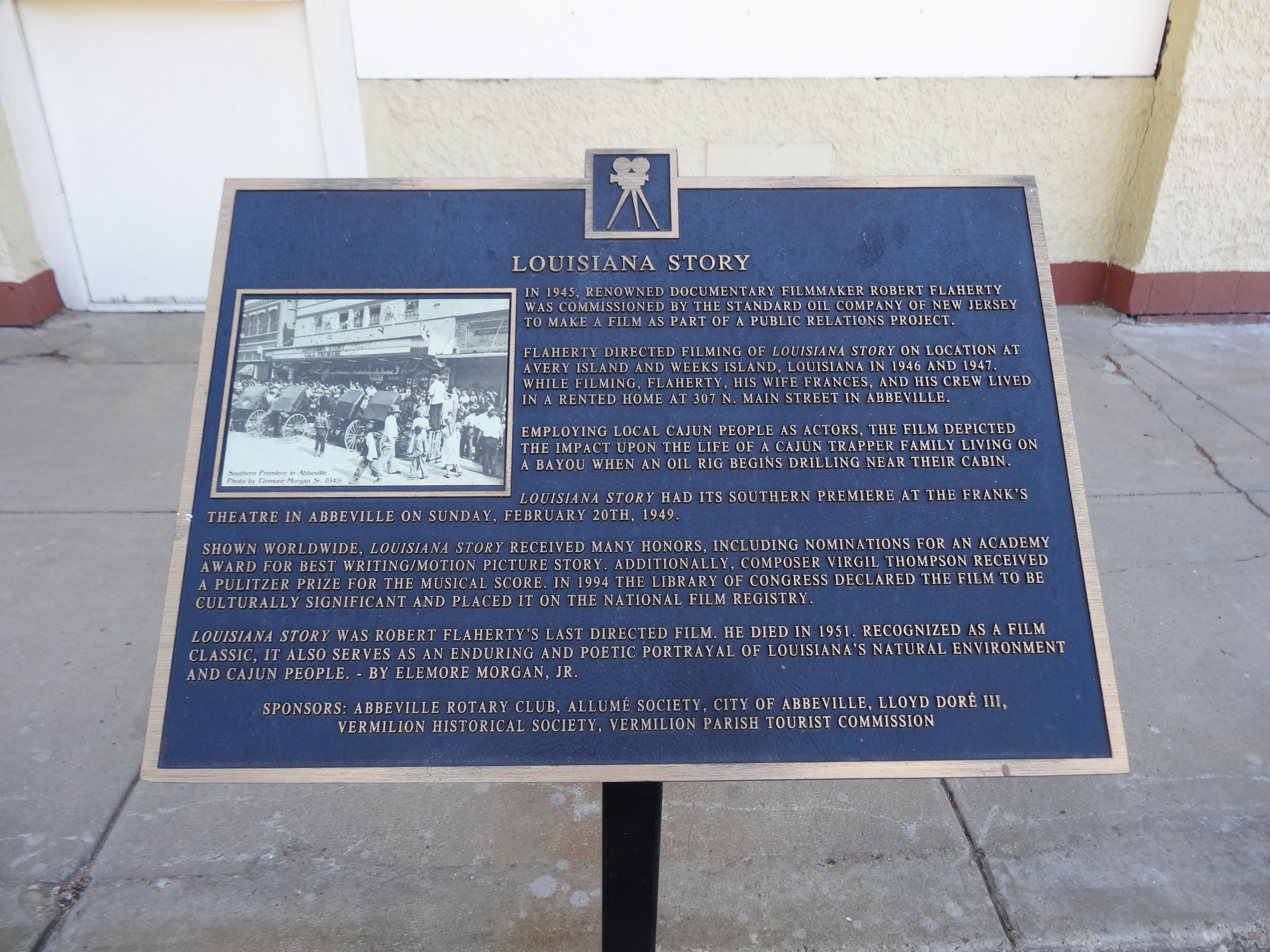
Louisiana Story Historic Marker, Abbeville, LA

Shucks!
Abbeville, LA

Downtown Kaplan

Barbed With A View

Abbeville Park

Steen's Pure Cane Syrup, Abbeville, LA

Photography Weekly Challenge (Flags)

Lafayette LA Elias G Bridge

Vermilion River Reflections

Maurice 090106 001 Leblanc Rd rice

Milton LA Bridge

a IMG_4435 indian bayou

a IMG_4420 indian bayou

a IMG_1545

a IMG_1540

a IMG_1550

SP3VE080 Bore Pit MP 68.6 hwy 35 near Honey Man Rd

Dan Lane, Toddy Guidry, Gary Byerly, Paul Conover, at Toddy Guidry residence

Gladu Rd.

Our place at Abbeville RV Park
Topographic Map of LA-, Maurice, LA, USA
Find elevation by address:

Places near LA-, Maurice, LA, USA:
Serene Road
6711 Enis Rd
6711 Enis Rd
6711 Enis Rd
10202 La-696
10202 La-696
10202 La-696
10202 La-696
10030 La-696
10010 La-696
10010 La-696
9840 La-697
10202 La-696
10010 La-696
10425 Cabrol Rd
10710 Sandra Dr
11, LA, USA
7219 La-700
7219 La-700
1210 Old Kaplan Hwy
Recent Searches:
- Elevation of Kambingan Sa Pansol Atbp., Purok 7 Pansol, Candaba, Pampanga, Philippines
- Elevation of Pinewood Dr, New Bern, NC, USA
- Elevation of Mountain View, CA, USA
- Elevation of Foligno, Province of Perugia, Italy
- Elevation of Blauwestad, Netherlands
- Elevation of Bella Terra Blvd, Estero, FL, USA
- Elevation of Estates Loop, Priest River, ID, USA
- Elevation of Woodland Oak Pl, Thousand Oaks, CA, USA
- Elevation of Brownsdale Rd, Renfrew, PA, USA
- Elevation of Corcoran Ln, Suffolk, VA, USA