Elevation of Karanjgaon, Maharashtra, India
Location: India > Maharashtra > Nashik >
Longitude: 74.0718702
Latitude: 20.0135982
Elevation: 543m / 1781feet
Barometric Pressure: 95KPa
Elevation Map:
Satellite Map:
Related Photos:

Fisherman

कालचक्र...

Pantropical jumper (Plexippus paykulli)

Pantropical jumper (Plexippus paykulli)
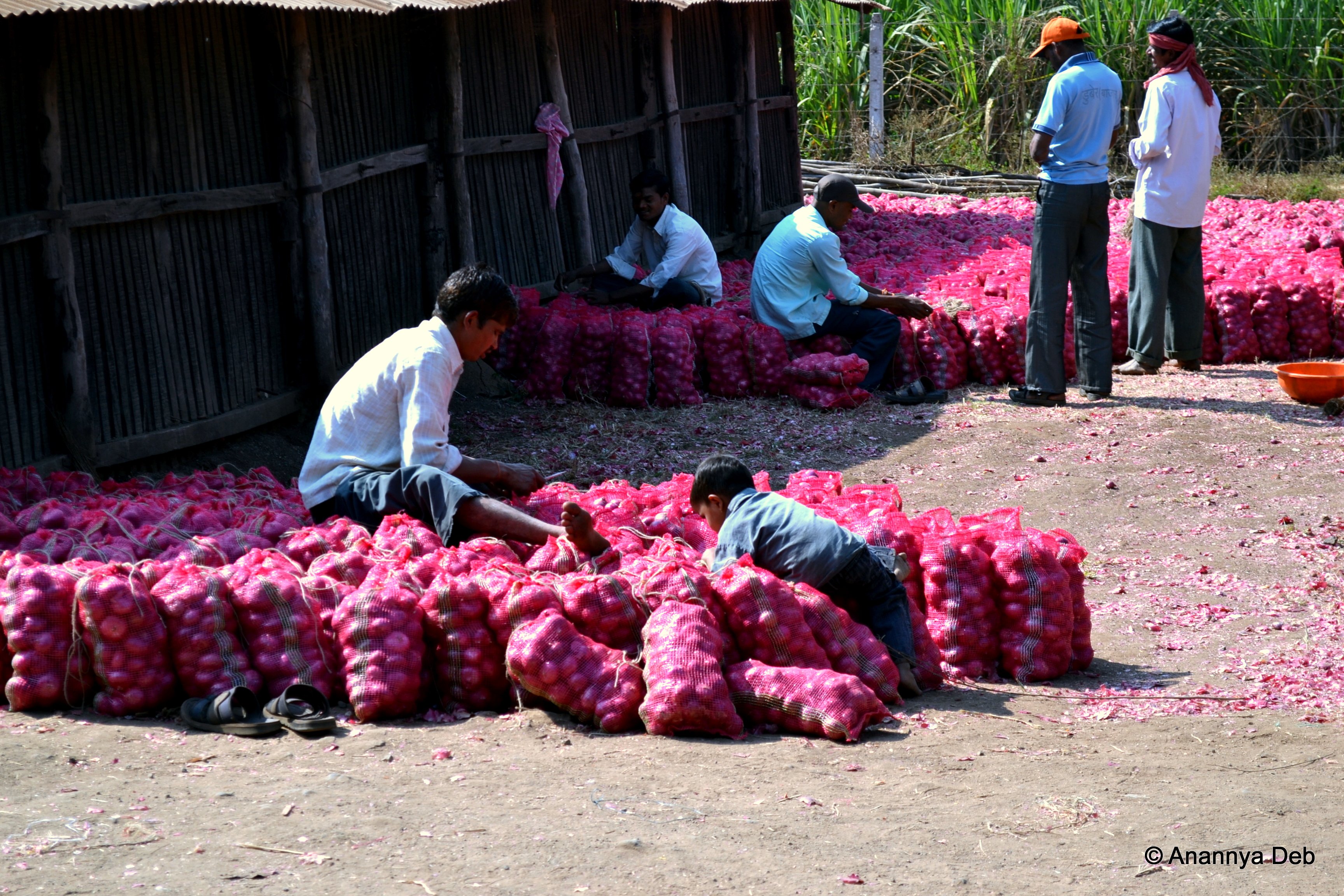
Onion trader depot, Saikheda, December 2011

Onion trader depot, Saikheda (Nashik), December 2011

Onions depot, Sakheda (Nashik), December 2011
Topographic Map of Karanjgaon, Maharashtra, India
Find elevation by address:

Places near Karanjgaon, Maharashtra, India:
Niphad
Nashik
Ojhar
Sinnar
Nehru Nager
Nehru Nagar
Nanavali
Panchavati
Nashik
Nandur Shingote
Sundarban Apartment
Tidke Nagar
Dindori
Asaram Bapu Bridge
Chandwad
Dhodap Fort
Sarul
Yeola Range Forest Office
Angangaon
Pimplad Nasik
Recent Searches:
- Elevation of SW 57th Ave, Portland, OR, USA
- Elevation of Crocker Dr, Vacaville, CA, USA
- Elevation of Pu Ngaol Community Meeting Hall, HWHM+3X7, Krong Saen Monourom, Cambodia
- Elevation of Royal Ontario Museum, Queens Park, Toronto, ON M5S 2C6, Canada
- Elevation of Groblershoop, South Africa
- Elevation of Power Generation Enterprises | Industrial Diesel Generators, Oak Ave, Canyon Country, CA, USA
- Elevation of Chesaw Rd, Oroville, WA, USA
- Elevation of N, Mt Pleasant, UT, USA
- Elevation of 6 Rue Jules Ferry, Beausoleil, France
- Elevation of Sattva Horizon, 4JC6+G9P, Vinayak Nagar, Kattigenahalli, Bengaluru, Karnataka, India