Jongsong Peak Elevation
Address: Jongsong Peak
Longitude: 88.1352391
Latitude: 27.8815937
Elevation: 7433m / 24386feet
Barometric Pressure: 39KPa
Elevation Map:
Satellite Map:
About:
Jongsong Peak is a mountain in the Janak section of theHimalayas. At 7,462 metres (24,482 ft) it is the 57th highest peak in the world, although it is dominated by 3rd highest, Kangchenjunga, 20 km (12 mi) to the south. Jongsong's summit is on tri-junction of India, Nepal and China..
From its first ascent in 1930 by members of German expedition led by Gunther Dyhrenfurth until the first ascent of Kamet on 21 June 1931, Jongsong was the highest climbed peak in the world. The first ascent team of Jongsong peak had included several members who were also members of the International mountaineering organisation Himalayan Club.
Related Photos:
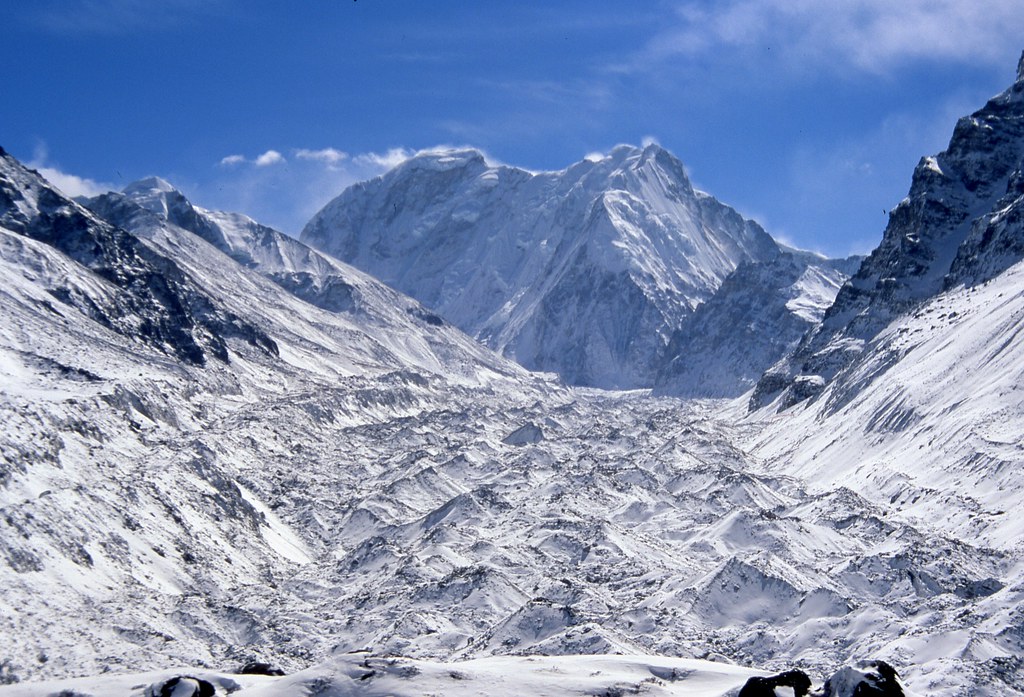
Nepal_1997_027 View up glacier from Lhonak (KF-41)

Nepal_1997_024 View down glacier from Lhonak (KF-36)
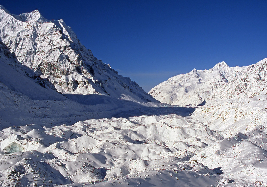
Nepal_1997_021 (KF-32) View down glacier from Lhonak

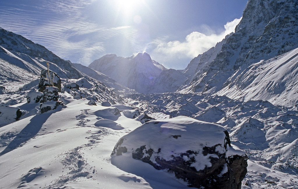
Nepal_1997_018 Lhonak - early morning (KF-26)

Nepal_1997_017 Lhonak - early morning (KF-24)
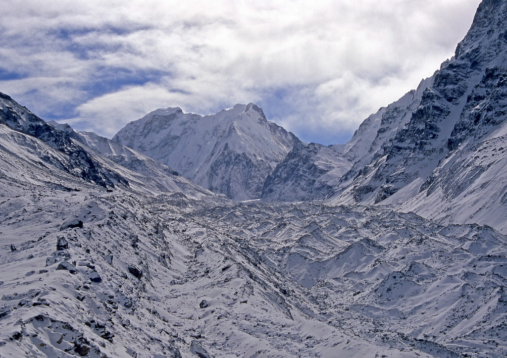
Nepal_1997_023 View up glacier from Lhonak (KF-35)
Nepal_1997_022 View up glacier from Lhonak (KF-33)
Topographic Map of Jongsong Peak
Find elevation by address:

Places near Jongsong Peak:
Ch'a-pu-k'o-la
Kirat Chuli
Lelep
Gimmigela Chuli
Kangchenjunga
Zemu Glacier
Jannu
North Sikkim
Taplejung
Lachen
Ri'og
Lingthem
Sikkim
Yuksom
Hee-gyathang
Pelling
Sokpay
Govt Secondary School
West Sikkim
Namok
Recent Searches:
- Elevation of Corso Fratelli Cairoli, 35, Macerata MC, Italy
- Elevation of Tallevast Rd, Sarasota, FL, USA
- Elevation of 4th St E, Sonoma, CA, USA
- Elevation of Black Hollow Rd, Pennsdale, PA, USA
- Elevation of Oakland Ave, Williamsport, PA, USA
- Elevation of Pedrógão Grande, Portugal
- Elevation of Klee Dr, Martinsburg, WV, USA
- Elevation of Via Roma, Pieranica CR, Italy
- Elevation of Tavkvetili Mountain, Georgia
- Elevation of Hartfords Bluff Cir, Mt Pleasant, SC, USA