Elevation of Industrial Estate, Ichalkaranji, Maharashtra, India
Location: Kagwade Mala > Ichalkaranji >
Longitude: 74.4554936
Latitude: 16.7137072
Elevation: 578m / 1896feet
Barometric Pressure: 95KPa
Elevation Map:
Satellite Map:
Related Photos:

DMIT Test , Counselling

DMIT Test , Counselling

Image acquired by Sentinel-2A on 2019 January 30 at 5:44 UTC. Centre coordinates: 16.69 N, 74.58 E.

Village turns golden...
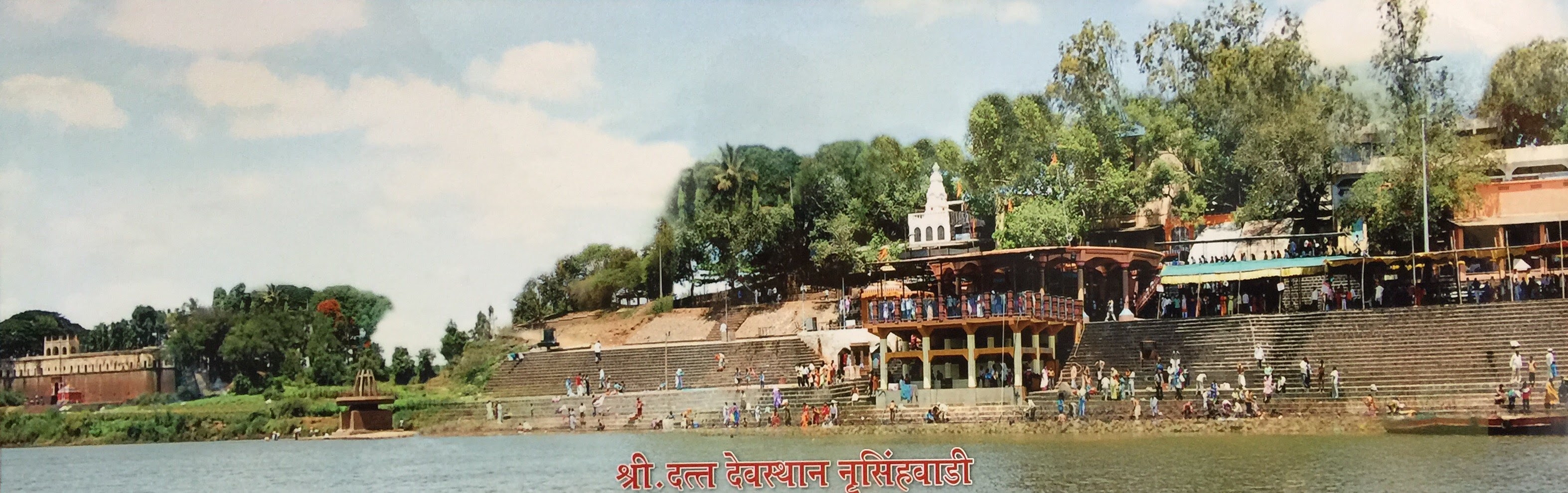
कणेरी मठ, पेठचा गणपती, जोतिबा, नरसोबाची वाडी, महालक्ष्मी कोल्हापूर.
कणेरी मठ, पेठचा गणपती, जोतिबा, नरसोबाची वाडी, महालक्ष्मी कोल्हापूर.

कणेरी मठ, पेठचा गणपती, जोतिबा, नरसोबाची वाडी, महालक्ष्मी कोल्हापूर.

कणेरी मठ, पेठचा गणपती, जोतिबा, नरसोबाची वाडी, महालक्ष्मी कोल्हापूर.

कणेरी मठ, पेठचा गणपती, जोतिबा, नरसोबाची वाडी, महालक्ष्मी कोल्हापूर.

कणेरी मठ, पेठचा गणपती, जोतिबा, नरसोबाची वाडी, महालक्ष्मी कोल्हापूर.

#geocaching #cryptex #kryptex #d5 #tradi #archived :-/

Helicopter...!!!

@Panchaganga

@Panchaganga

07072008(023)_NLT
Topographic Map of Industrial Estate, Ichalkaranji, Maharashtra, India
Find elevation by address:

Places in Industrial Estate, Ichalkaranji, Maharashtra, India:
Places near Industrial Estate, Ichalkaranji, Maharashtra, India:
Ganesh Nagar
Gaonbhag
Karande Mala
Sarvoday Nagar
Vikram Nagar
Kabnur
Torna Nagar
Radhakrishna Colony
Shree Samarath Nagar
Vrindavan Colony
Tardal
Korochi
Mateen Fabrciators & Contractors
Hatkanangale
Yadrav
Khotwadi
Tilawani
Kolhapur - Sangli Highway
Shri Laxmi Co-op. Industrial Estate
Kondigre
Recent Searches:
- Elevation of Lust Road, Lust Rd, Florida, USA
- Elevation of Pleasant Valley Rd NW, Adairsville, GA, USA
- Elevation of Općina Šodolovci, Croatia
- Elevation of Šodolovci, Croatia
- Elevation of Old Clairton Rd, Jefferson Hills, PA, USA
- Elevation of st Ave SE, Lisbon, ND, USA
- Elevation of Steamboat Island Road Northwest, Olympia, WA, USA
- Elevation of Kootenai Trail Rd, Bonners Ferry, ID, USA
- Elevation of Hickory Blvd, Bonita Springs, FL, USA
- Elevation of Lalagbene, Bayelsa, Nigeria