Elevation of Horseshoe Bend Rd, Orange, TX, USA
Location: United States > Texas > Orange County > Orange >
Longitude: -93.885409
Latitude: 30.223409
Elevation: -10000m / -32808feet
Barometric Pressure: 295KPa
Elevation Map:
Satellite Map:
Related Photos:
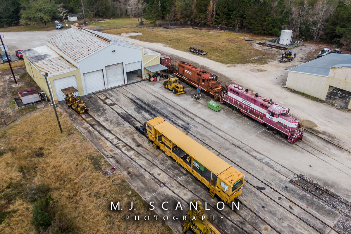
SRN 1751 | EMD GP7 | Sabine River & Northern

UP ONOAA 30, Echo, TX
KCS IMXSH 27, Mauriceville, TX

KCS GKCMX 22, Maruiceville, TX

Sabine River & Northern Orange, Texas

USA - Louisiana - Route 10 to New Orleans

TX FM 1441

I-10 West - Exit 864 - FM1132 + FM1135

KCS GJVSJI22, Vidor, TX

KCS MNSEW25, Mauriceville, TX

Sabine River & Northern SRN 1751 (GP7) Orange, Texas
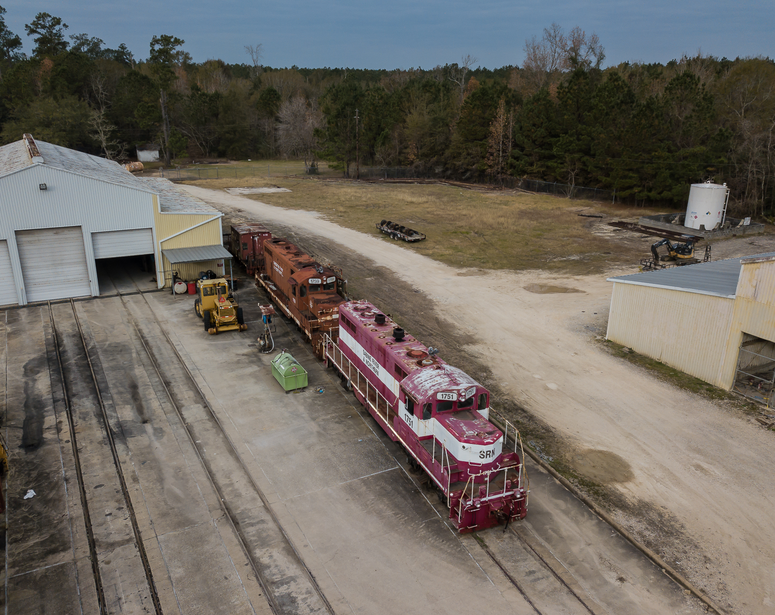
Sabine River & Northern

USA - Louisiana - Route 10 to New Orleans

USA - Louisiana - Route 10 to New Orleans

Disply of model cars at Wright's Bar-B-Q in Vidor.

Timberlane - Lakeside (1)

Timberlane - Lakeside (3)

Tram - Old (3)

I-10 TX EB past TX 12

UP MAVBT 10, Echo, TX

UP MPBBW 09 and UP QLYTNJ 09, Echo, TX

UP URLFUJ 22, Echo, TX

UP SNOYR 17, Echo, TX

KCS 2GBVKC 06, Lemonville, TX
Topographic Map of Horseshoe Bend Rd, Orange, TX, USA
Find elevation by address:

Places near Horseshoe Bend Rd, Orange, TX, USA:
6590 Horseshoe Bend Rd
2851 Texla Rd
2802 Texla Rd
2802 Texla Rd
2802 Texla Rd
2802 Texla Rd
2802 Texla Rd
9055 Westbend Rd
Hickory Bend Drive
301 Crosstimber Dr
5700 Len Dr
Market Basket
Len Drive
4750 Len Dr
5021 Tranquility Rd
21714 Fm 1130
9151 Twin Lakes Rd
9249 Twin Lakes Rd
7921 Cowpen Road
9429 Trinity Rd
Recent Searches:
- Elevation of Leguwa, Nepal
- Elevation of County Rd, Enterprise, AL, USA
- Elevation of Kolchuginsky District, Vladimir Oblast, Russia
- Elevation of Shustino, Vladimir Oblast, Russia
- Elevation of Lampiasi St, Sarasota, FL, USA
- Elevation of Elwyn Dr, Roanoke Rapids, NC, USA
- Elevation of Congressional Dr, Stevensville, MD, USA
- Elevation of Bellview Rd, McLean, VA, USA
- Elevation of Stage Island Rd, Chatham, MA, USA
- Elevation of Shibuya Scramble Crossing, 21 Udagawacho, Shibuya City, Tokyo -, Japan