Elevation of Holly Hill Dr, Hendersonville, NC, USA

Location: United States > North Carolina > Henderson County > Hendersonville >

Longitude: -82.495461

Latitude: 35.3450009

Elevation: 702m / 2303feet

Barometric Pressure: 93KPa

Elevation Map:

elevation map of Holly Hill Dr, Hendersonville, NC, USA

Satellite Map:

Satellite map of Holly Hill Dr, Hendersonville, NC, USA

Related Photos:

blueridge appalachians fall autumn sunrise landscape color northcarolina westernnorthcarolina canoneos6d canonef24105mmf4lisusm
Island in the Fog
westernnorthcarolina pisgah blueridge appalachians mountains sunset rain layers summer misty canon70200f28isl canon7dmkii
sunset 8-16-2017
sunset westernnorthcarolina color blueridge appalachians canoneos6d canonef70200f28lis
sunset 3-26-20
bearfootin’publicartwalk bear statue sculpture
Hendersonville Bears 13 - Into The Wild
jet plane airport aviation flight tickets airline passenger travel visit destination firstclass luxury airplane fly asheville northcarolina ashevilleregionalairport avl runway16 landing aerialview runway pilotview aerialphotographer aerialphotography approach mountains wnc buncombecounty unitedstates
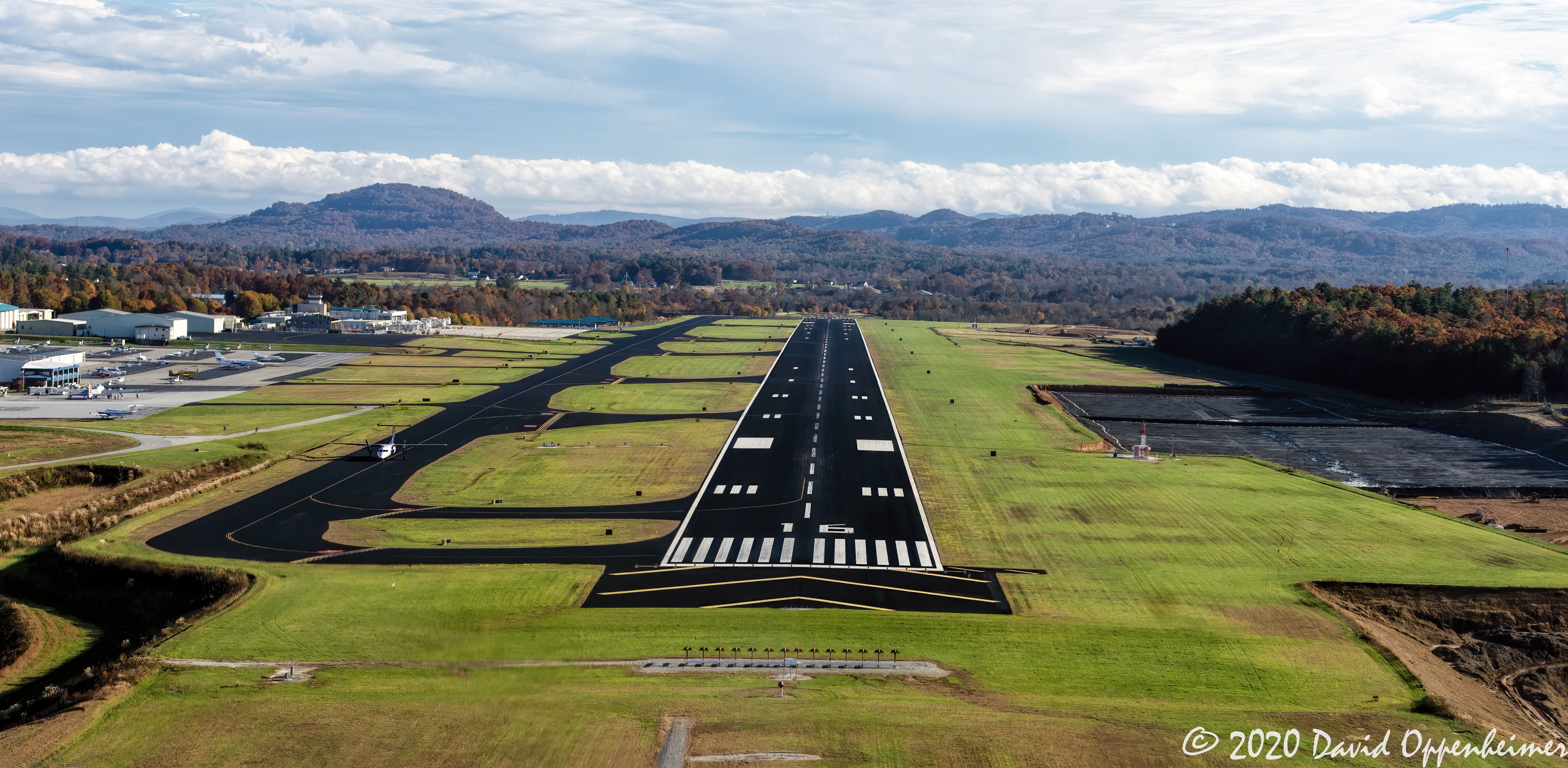
Asheville Regional Airport Runway 16 Landing Approach Aerial View
lakesummit lakesummitrealestate lakesummitaerial tuxedo tuxedorealestate tuxedoaerial zirconia hendersoncounty land property blueridgemountains saludamountains saluda summercamp camp lake aerial realestate waterfront lakefront mountains scenic nc northcarolina luxury aerialphoto wnc color horizontal unitedstates usa spring westernnorthcarolina upstate
Lake Summit in Tuxedo North Carolina Aerial View
travel blue sunset vacation mist mountains fog sunrise outdoors evening nc natural asheville north foggy northcarolina adventure ridge valley parkway carolina destination smoky peaks appalachia vapor blueridgeparkway ridges ashevegas appalachians ashevillenc ashvegas southernappalachians ashevilleairport mygearandme mygearandmepremium mygearandmebronze mygearandmesilver mygearandmegold mygearandmeplatinum mygearandmediamond
Welcome to Asheville NC - Blue Ridge Mountains Sunset
sign nc northcarolina townhall flatrock rockwork flatrocknc nikor1685vr
Flat Rock Village Hall
trafficlights trafficlight pvmccainstrafficlights pvmccainstrafficlight pvmccains pvmccain
PV McCain Traffic Lights
house mountain home exterior estate interior rustic basement blueprint manor craftsman floorplans jasperhill housedesign homedesign 5020 houseplans luxuryhome donaldgardner hillsidewalkout
Plan #5020-The Jasper Hill
thedreamrocket internationalfibercollaborative saturnvrocket space nasa astronaut conservation aliens twintowers health family diversity glitter christmas newyork nova art environment clean trees water trash planting green people cancer group equality paint flag elementary school home humans agriculture mountain save leader unitedstatesofamerica facebook felt kentucky washington olympic peace presidentobama stars community global kids express explore discover war animal abuse racism religious intolerance
Sugarloaf Elementary School, Hendersonville, NC
trafficlights trafficlight pvmccainstrafficlights pvmccainstrafficlight pvmccains pvmccain
PV McCain Traffic Lights
trafficlights trafficlight pvmccainstrafficlights pvmccainstrafficlight pvmccains pvmccain
PV McCain Traffic Lights
sunset summer woman sun girl silhouette evening nc nikon child daughter silhouettes sigma bubbles blowing hendersonville bubble brianna setting wnc d300 105mm
Into the Evening Air
trafficlights trafficlight trafficsystem trafficsystems pvmccainstrafficlights pvmccainstrafficlight pvmccains pvmccain
PV McCains Traffic Lights
trafficlights trafficlight pvmccainstrafficlights pvmccainstrafficlight pvmccains pvmccain
PV McCain Traffic Lights
jacksoncounty northcarolina realestate property land aerial clouds landscape travel view spring sunshine orange mountainline blueridgemountains appalachianmountainssunset appalachianmountains blueridgemountainssunset mountains wnc westernnorthcarolina silhouette unitedstates usa
Jackson County North Carolina Aerial Sunset
canon butterfly rebel northcarolina canonrebel rebelxt canonrebelxt eosrebel arden kamote naturesfinest pinoyako hbw bokehlicious rebelxti eos400d eosrebelxti teampilipinas kamoteus2003 kamoteus burabog ronmiguelrn
hbw... happy butterfly wednesday my friends!
canadian pacific fletcher north carolina blu w84 blue ridge southern watco
Hunter lives the high life.
flatrock northcarolina unitedstates us
Orange Peppers
winter sunset sky sun mountains rock clouds landscape nc jump december view asheville dusk northcarolina off hendersonville laurelpark jumpoffrock hendersonvillenc
Early December Sunset
tree trees sun sunlight sunbeam leaf leafs fall winter autumn grass restarea interstate i26 interstatei26 apertureprioritymode wideanglelens 1018mmlens 10mm asheville ashevillenc northcarolina canont5i canon bluesky redleaves t5i 700d canon700d placescity
Asheville, North Carolina
blackandwhite anseladams lowkey sooc square landscape iphoneart iphone hipstamatic monochrome bw
Sunrise Tryon
blueridge westernnorthcarolina sunrise light mountains clouds blueridgemountains landscape canoneosm6mkii canonefm18150
Blue Ridge becomes the Red Ridge
ansel iphoneart blackandwhite hipstamatic
Low Key
trees mist grass fog barn rural landscape spring nebel farm northcarolina infrared
Mountain Magenta
park usa geotagged nc unitedstates map northcarolina hendersonville greenspace flatrock themeadows wnc parkmap westernnorthcarolina publicpark hendersoncounty hendersonvillenc flatrocknorthcarolina flatrocknc kingcreek conceptualmap nikonsigma hendersonvillenorthcarolina oldgolfcourse hendersoncountync hendersoncountynorthcarolina dyecreek theparkatflatrock highlandlakegolfclub preliminarymap geo:lat=3529175697 geo:lon=8243640125
The Park At Flat Rock (Flat Rock, North Carolina)
flatrock northcarolina carlsandburg nationalhistoricsite carl sandburg national historic site landscape water reflection south southern house nc flat rock north carolina
The Carl Sandburg National Historic Site
fog mist autumn northcarolina trees landscape rural
Road to Nowhere
longexposure trees summer usa motion blur green nature water leaves rock creek forest river landscape geotagged outdoors photography landscapes waterfall nc nikon scenery rocks stream slow unitedstates natural outdoor scenic northcarolina falls foliage motionblur waterfalls riverbed slowshutter carolina serene flowing mountainside polarizer sevenfalls basslake silky cpl watercourse circularpolarizer frenchbroadriver d800 fstop waterflow wnc rrs etowah naturesfinest westernnorthcarolina flowingwater etowahnc gorelake nikond800 fstopbag littlewillowcreek reallyrightstufftripod smilky fstoploka etowahnorthcarolina pleasantgrovechurchroad sevenfallsetowah sevenfallsetowahnc geo:lat=3528269177 geo:lon=8259793997
Seven Falls (Etowah, North Carolina)
sooc ruleofthirds ipad sunrise monochrome nc iphoneart iphoneography hipstamatic
First light
light amazing jumpoffrock nc daveallen laurelpark frost ice winter landscape trees tree frozen frozenlandscape outdoors nature cold nikon d700 1735mm singleexposure northcarolina carolina blueridgemountains nikond700 dramaticsky hendersonville photography westernnorthcarolina platinumpeaceaward mygearandmeplatinum platinumheartaward eveninglight hendersonvillenc icytrees frosty icecold backlighting backlight backlit sunlight crystals winterlandscape mygearandmediamond artistoftheyearlevel6 hoarfrost
Jump Off Rock Hendersonville NC in Amazing Light - Luminous
bwlandscape misty blackandwhite hipstamatic iphoneart iphoneography iphone pond nc
Morning Mist
longexposure trees summer usa motion blur green nature water leaves rock creek forest river landscape geotagged outdoors photography landscapes waterfall nc nikon scenery rocks stream slow unitedstates natural outdoor scenic northcarolina falls foliage motionblur waterfalls riverbed slowshutter carolina serene flowing mountainside polarizer sevenfalls basslake silky cpl watercourse circularpolarizer frenchbroadriver d800 fstop waterflow wnc rrs etowah naturesfinest westernnorthcarolina flowingwater etowahnc gorelake nikond800 fstopbag littlewillowcreek reallyrightstufftripod smilky fstoploka geo:lat=3528280124 geo:lon=8259795338 etowahnorthcarolina pleasantgrovechurchroad sevenfallsetowah sevenfallsetowahnc
Seven Falls (Etowah, North Carolina)
planet sunrise nc hipstamatic
Good Morning
hipstamatic highkey sooc
Fine Art
ipad monochrome sooc hipstamatic
Shades of Brown
longexposure trees summer usa motion blur green nature water leaves rock creek forest river landscape geotagged outdoors photography landscapes waterfall nc nikon scenery rocks stream slow unitedstates natural outdoor scenic northcarolina falls foliage motionblur waterfalls riverbed slowshutter carolina serene flowing mountainside polarizer sevenfalls basslake silky cpl watercourse circularpolarizer frenchbroadriver d800 fstop waterflow wnc rrs etowah naturesfinest westernnorthcarolina flowingwater etowahnc gorelake nikond800 fstopbag littlewillowcreek reallyrightstufftripod smilky fstoploka etowahnorthcarolina pleasantgrovechurchroad sevenfallsetowah sevenfallsetowahnc geo:lat=3528269177 geo:lon=8259793997
Seven Falls (Etowah, North Carolina)
trees reflection green water leaves nc moss log rocks branches peaceful bank northcarolina trunk lush riverbank gnarled twisty pisgahnationalforest hendersoncounty northmillsriver sittingbytheriver “flickraward” davidhopkinsphotography ncpedia
Green Peace...
maple tree leaves fall foliage autumn change leaf falling shutter speed daveallen blueridgemountains motion 70200mm 28 northcarolina nikond300 nikon d300 daveallenphotography nature landscape outdoors wnc westernnorthcarolina natural season vibrant trees sun seasons hendersonville forest fallfoliage colorful carolina bokeh blueridge ashevillenc mapletreesinautumn autumnmaples mapleleaves rowoftrees hendersonvillenc laurelpark laurelparknc mygearandmediamond reallyrightstuff nikond800 outdoorphotographer scenic
Autumn Maple Trees Fall Foliage - Wonderland