Elevation of Historic Columbia River Hwy, Corbett, OR, USA

Location: United States > Oregon > Multnomah County > Corbett >

Longitude: -122.29726

Latitude: 45.5306355

Elevation: 203m / 666feet

Barometric Pressure: 99KPa

Elevation Map:

elevation map of Historic Columbia River Hwy, Corbett, OR, USA

Satellite Map:

Satellite map of Historic Columbia River Hwy, Corbett, OR, USA

Related Photos:

view gorge columbia columbiarivergorge womens womansforum vista vistahouse rainbow water river trees tree green light sunlight clouds weather rain tripod oregon statepark canon cats
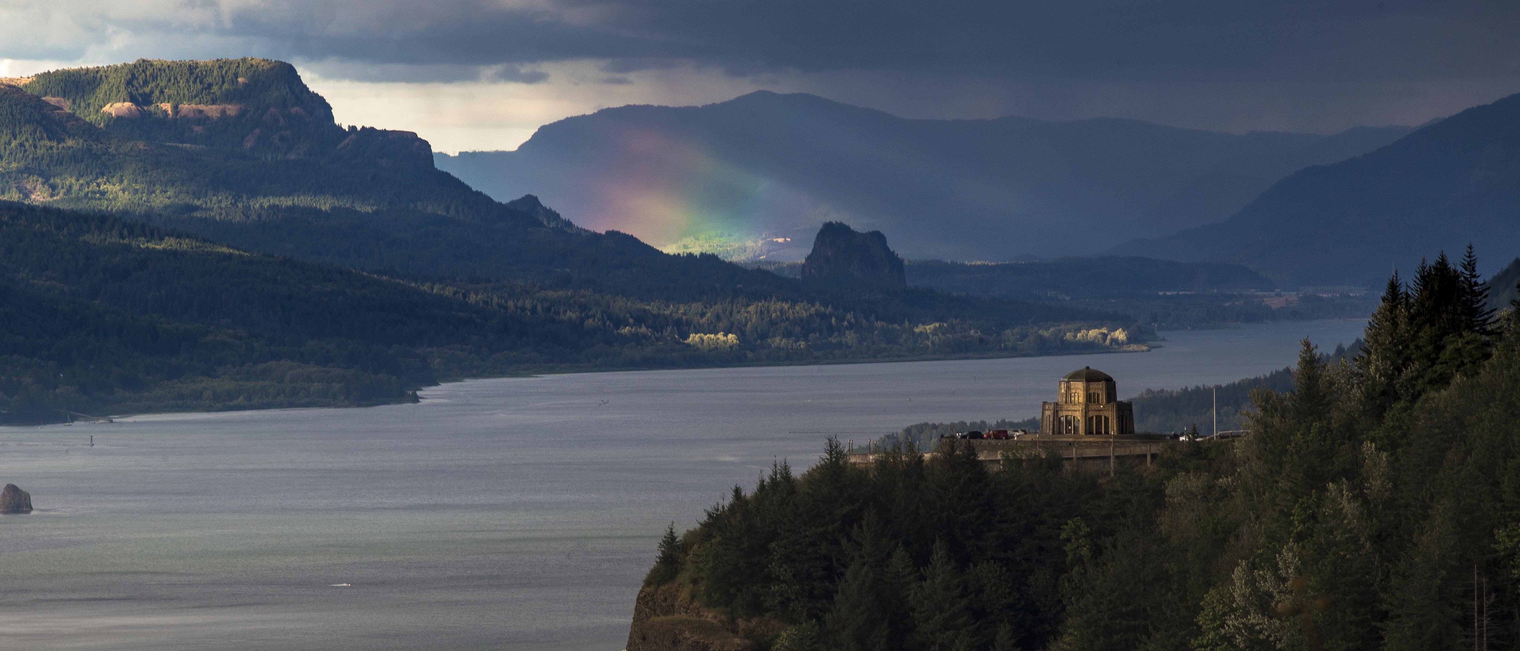
Rainbow in the Columbia River Gorge
multnomahfalls waterfall oregon columbiagorge famousplace pacificnorthwest autumn fall film largeformat viewcamera filmphotography westernusa garyquay sinar ilford ortho ilfordphoto
Multnomah Falls, November 2012
crownpoint columbiagorge oregon washington pacificnorthwest nature landscape columbiariver winter clouds cloudporn light storm sunset nikon garyquay bw
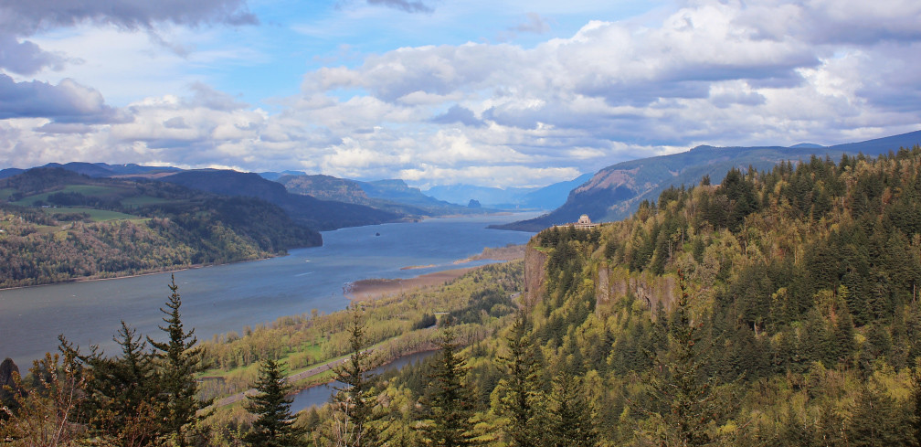
The Columbia Gorge from Crown Point, Dec 2019
Rainy Day over the Columbia River Near Portland OR USA-7a
mthood sandyriver home
View from My Place
wahkeenafalls waterfall water cascade columiagorge oregon columbiarivergorge nikon garyquay moss spring springtime outside ourdoors
Wahkeena Falls Under the Road
Rainy Day Looking Towards Latourell Fall Near Portland OR USA-6a (in Explore)
multnomahfalls oregon usa roadtrip outdoors waterfall bridge fall nikond850 longexposure
Multnomah Falls
jonsurdpoint mthood cascaderange cascademountains portland oregon roadtrip summer spring pacificnorthwest green forests meadows volcano
When ambition ends, happiness begins…
trees nature oregon waterfall unitedstates footbridge or canvas waterfalls portfolio hillside day8 lowerfalls multnomahfalls columbiarivergorge upperfalls historiccolumbiariverhighway lookingse project365 nationalscenicarea columbiarivergorgenationalscenicarea multnomahfallsarea colorefexpro usroute30 eccezionale bensonfootbridge columbiariverhwy 620feet tallestwaterfallinthestateoforegon nikond800e capturenx2edited hillsideoftrees historiccolumbiariverhighwayscenicbyway triptomountrainierandcolumbiarivergorge 620waterfall
The Wonderful Beauty of Multnomah Falls
columbiariver sandisland roosterrock statepark or oregon water river
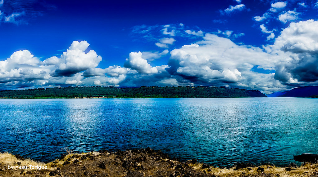
Columbia River and Sand Island
instagramapp square squareformat iphoneography uploaded:by=instagram
Multnomah Falls in winter . . . . #multnomahfalls #waterfallsfordays #pdx #waterfall #pdxnow #travelportland #exploreportland #explorecreateshare #purplepassport #winter #frozenwaterfall #traveloregon #exploreoregon #oregonexplored #cascadiaexplored #expl
longexposure bridge trees portrait nature water pool oregon creek forest landscape us waterfall stream unitedstates or olympus cascades pacificnorthwest multnomah multnomahfalls omd columbiarivergorge cascaderange cascadelocks nationalscenicarea em5 1250mmf3563mzuiko
Multnomah in Full
statepark usa mountain building field station stone architecture oregon vintage point landscape photo site highway view outdoor or hill scenic columbia historic hwy ridge observatory vista historical crown block register mountainside pioneers comfort crownpoint grassland multnomah attraction oregonstate corbett foothill vistahouse scenicdrive multnomahcounty nrhp memoral onasill gorgeld
Vista House ~Oregon State ~ Columbia Gorge ~ My Old Photo
wahkeenafalls oregon pacificnorthwest waterfall columbiagorge largeformat velvia fuji filmphotography water autumn
Wahkeena Falls, Early Autumn 2014
canonef24105mmf4lisusm canoneos6d columbiarivergorge crownpointvistahouse or oregon pnw pacificnorthwest samanthadecker
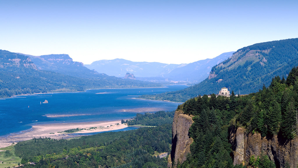
Classic View of the Columbia River Gorge
longexposure sunset water rock clouds oregon canon river landscape or sigma columbia pacificnorthwest northamerica portlandoregon cpl columbiarivergorge desaturate circularpolarizerfilter neutraldensityfilter circularpolarizingfilter canoneos70d
Columbia River Sunset
nikond800e day8 capturenx2edited colorefexpro triptomountrainierandcolumbiarivergorge columbiarivergorge columbiarivergorgenationalscenicarea columbiariverhwy usroute30 historiccolumbiariverhighway historiccolumbiariverhighwayscenicbyway project365 nature portfolio canvas nationalscenicarea hillside hillsideoftrees trees blueskieswithclouds angelsrest mounthoodarea oregoncascades cascaderange pacificranges chanticleerpoint overlook columbiariver river lookingtovistahouse vistahouseoffindistance lookingtocrownpoint crownpointoffindistance portlandwomensforumstate sandisland lookingeast or unitedstates
Views of the Columbia River at Chanticleer Point
angelsrest aroundcrownpoint aroundvistahouse autumn blueskieswithclouds capturenx2edited carsdriving cascaderange colorefexpro colors columbiariver columbiarivergorge columbiarivergorgenationalscenicarea columbiariverhwy creek crownpointvistahouse day8 highway hillside hillsideoftrees historiccolumbiariverhighway historiccolumbiariverhighwayscenicbyway interstate84 lookingeast meadow mounthoodarea multiplecolors multitudeofplantleafcolors nationalscenicarea nature nikond800e onbalconydeckatvistahouse oregoncascades pacificranges pixelmator portfolio project365 river sandisland trees triptomountrainierandcolumbiarivergorge usroute30 vistahouse youngcreek or unitedstates
From Near to Far While Taking in the Gorge
multnomahcounty columbiarivergorge pacificnorthwest autumndrive fall vistahouse oregon
Vista House View - Historic Columbia River Highway in Autumn
autumn beautiful beauty bridge brown clean color colors columbia creek environment fall falls flow foliage forest gorge green landscape motion multnomah natural nature oregon outdoor outdoors pacific park places plant portland pretty red river rock scenery scenic season spring stone stream travel usa vertical view water waterfall white wood yellow
Multnomah Falls & Long Exposure
columbia river gorge washington oregon or april 2017 landscape canyon crown point vista house
Columbia River Gorge
View of Columbia River Near Portland OR USA-5a
usa oregon columbia benson columbiagorge multnomah bensonbridge ystenes mygearandme mygearandmepremium mygearandmebronze mygearandmesilver mygearandmegold mygearandmeplatinum mygearandmediamond martinystenes flickrstruereflection1 flickrstruereflection2
Benson Bridge (My #1000 in Hearts awards)
falls oregon multnomah forest
Multnomah Falls
bridalveilfalls columbiarivergorge oregon landscape waterfall corbett unitedstates us
Bridal Veil Falls
statepark usa building station architecture oregon vintage point photo site highway view or scenic columbia historic hwy observatory vista historical crown register pioneers comfort crownpoint multnomah attraction oregonstate corbett vistahouse scenicdrive nrhp memoral onasill gorgeld multnomahcount
Vista House ~Oregon State ~ Columbia Gorge ~ My Old Photo
sky nature oregon river landscape outdoor sony columbiariver oregonstate 70200mm vistahouse a6000 historiccolumbiariverhwy
Columbia River
columbiarivergorge oregon landscape waterfall fairyfalls corbett unitedstates us
Fairy Falls
longexposure bridge waterfall columbiarivergorge tieredfalls multnomagfalls
The way to love anything is to realize that it may be lost…
usa oregon portland waterfall or multnomah
Multnomah Falls
trees washington washougal unitedstates stateofwashington tree untedstatesofamerica
Washougal, Washington
washington columbiariver washougal clouds unitedstates stateofwashington cloud untedstatesofamerica
Washougal, Washington
usa midwest columbiariver breathe ontheroad multnomahfalls respiro fermatifermatifermati
il fiume va (sa dove andare)
cloud clouds stateofwashington tree trees unitedstates untedstatesofamerica washington washougal
Washougal, Washington
multnomahfalls columbiarivergorge
Multnomah Falls
trees washington washougal unitedstates stateofwashington tree untedstatesofamerica
Washougal, Washington
oregon hiking waterfall bridge multnomahfalls columbiarivergorge water landscape bensonbridge
Multnomah Falls
washington mounthood washougal clouds unitedstates stateofwashington cloud untedstatesofamerica
Washougal, Washington