Elevation map of Haut-Mbomou, Central African Republic
Location: Central African Republic >
Longitude: 25.4733554
Latitude: 6.2537134
Elevation: 637m / 2090feet
Barometric Pressure: 94KPa
Elevation Map:
Satellite Map:
Related Photos:
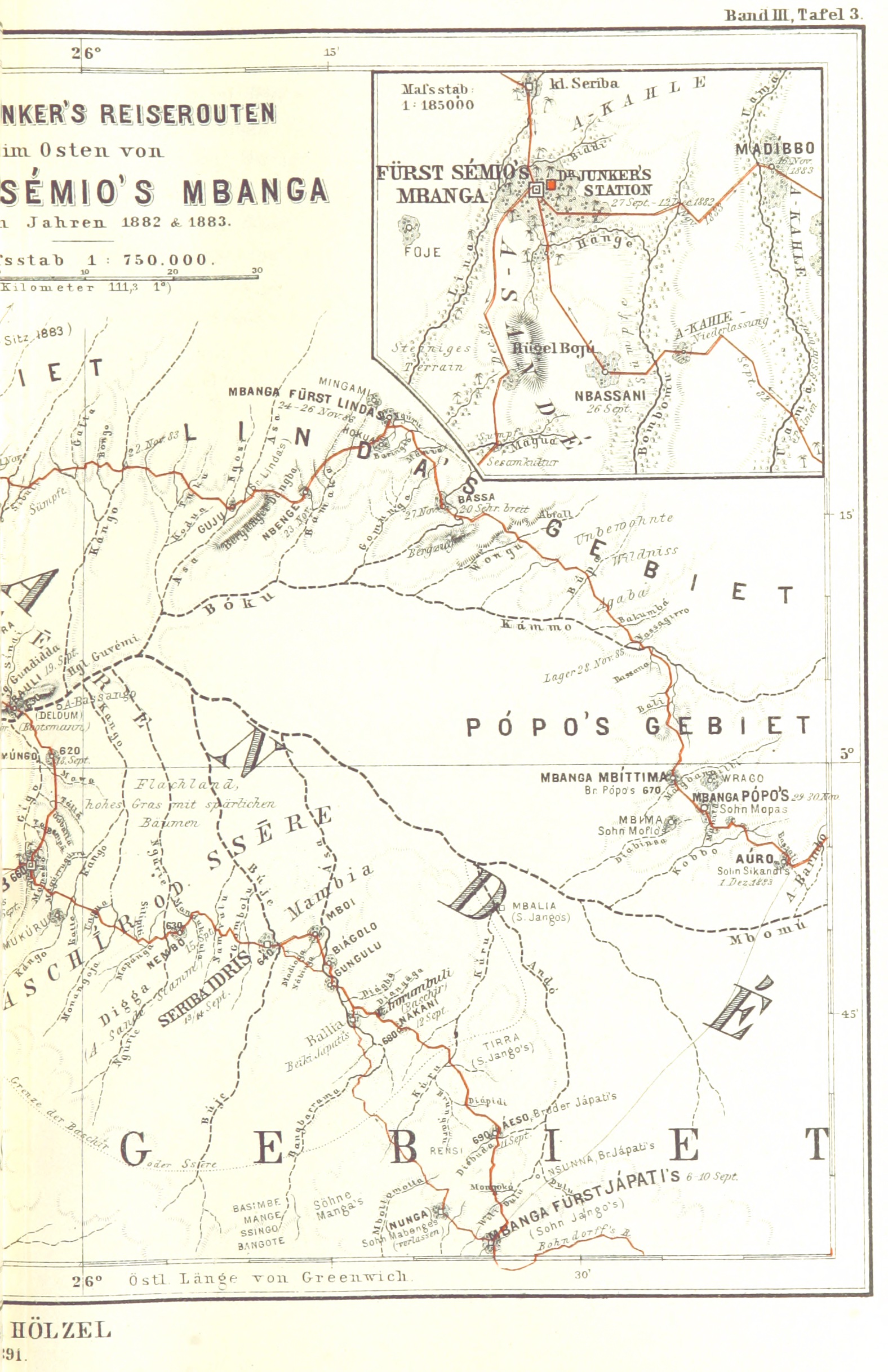
Image taken from page 187 of 'Dr. Wilh. Junker's Reisen in Afrika 1875-1886. Nach seinen Tagebüchern unter der Mitwirkung von R. Buchta herausgegeben von dem Reisenden ... Mit ... Original-Illustrationen, etc'
IMG_3588.JPG
IMG_3590.JPG
Topographic Map of Haut-Mbomou, Central African Republic
Find elevation by address:

Places in Haut-Mbomou, Central African Republic:
Recent Searches:
- Elevation of W Granada St, Tampa, FL, USA
- Elevation of Pykes Down, Ivybridge PL21 0BY, UK
- Elevation of Jalan Senandin, Lutong, Miri, Sarawak, Malaysia
- Elevation of Bilohirs'k
- Elevation of 30 Oak Lawn Dr, Barkhamsted, CT, USA
- Elevation of Luther Road, Luther Rd, Auburn, CA, USA
- Elevation of Unnamed Road, Respublika Severnaya Osetiya — Alaniya, Russia
- Elevation of Verkhny Fiagdon, North Ossetia–Alania Republic, Russia
- Elevation of F. Viola Hiway, San Rafael, Bulacan, Philippines
- Elevation of Herbage Dr, Gulfport, MS, USA