Elevation of Hardin, TX, USA
Location: United States > Texas > Liberty County >
Longitude: -94.739089
Latitude: 30.1524348
Elevation: 26m / 85feet
Barometric Pressure: 101KPa
Elevation Map:
Satellite Map:
Related Photos:

Point Bar on the Trinity River

Before The Storm

Fishing as KCS 4606 Crosses Trinity River on Union Pacific Railroad Bridge, Liberty, Texas 1301031608BW
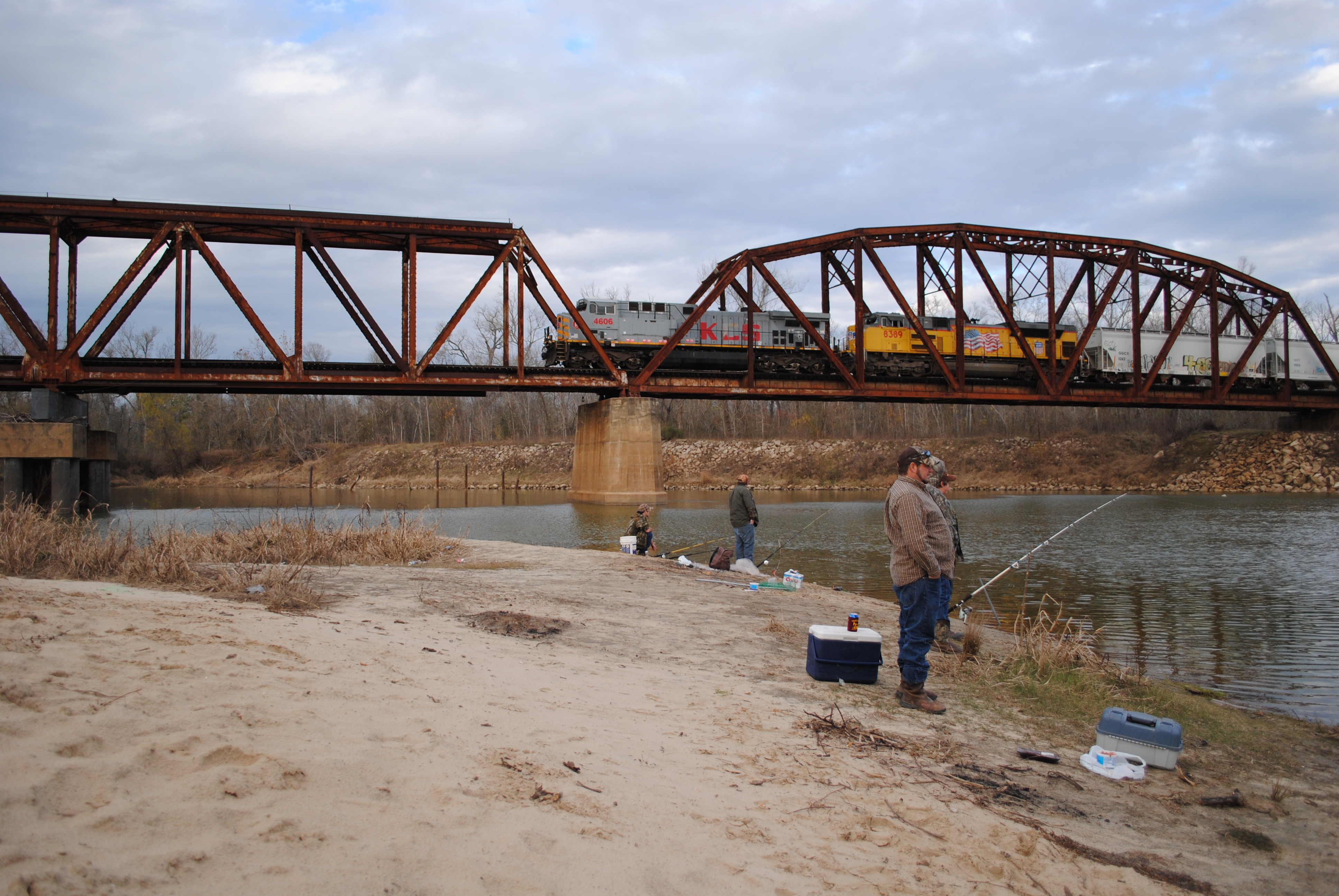
Fishing as KCS 4606 Crosses Trinity River on Union Pacific Railroad Bridge, Liberty, Texas 1301031610

Through the corral

Once red barn 1

The scary sinkhole ... cracks all over the place

20150609_065927~2

Sunset in the clouds

#texas #telephonepole #cross #sunset #sky #streetphotography #vagabond
Topographic Map of Hardin, TX, USA
Find elevation by address:

Places near Hardin, TX, USA:
1116 Co Rd 2016
Co Rd, Liberty, TX, USA
Co Rd, Liberty, TX, USA
County Road 2058
Co Rd, Liberty, TX, USA
Co Rd, Hull, TX, USA
4017 Hillcrest St
Co Rd, Hull, TX, USA
Liberty County
938 Minglewood Rd
County Road 2500
6002 Atascocita Dr
2525 Jefferson Dr
4003 Beaumont Rd
553 Co Rd 2106
410 Minglewood Rd
West Oak
West Oak
1019 Lynnwood Ave
Hull
Recent Searches:
- Elevation of Luther Road, Luther Rd, Auburn, CA, USA
- Elevation of Unnamed Road, Respublika Severnaya Osetiya — Alaniya, Russia
- Elevation of Verkhny Fiagdon, North Ossetia–Alania Republic, Russia
- Elevation of F. Viola Hiway, San Rafael, Bulacan, Philippines
- Elevation of Herbage Dr, Gulfport, MS, USA
- Elevation of Lilac Cir, Haldimand, ON N3W 2G9, Canada
- Elevation of Harrod Branch Road, Harrod Branch Rd, Kentucky, USA
- Elevation of Wyndham Grand Barbados Sam Lords Castle All Inclusive Resort, End of Belair Road, Long Bay, Bridgetown Barbados
- Elevation of Iga Trl, Maggie Valley, NC, USA
- Elevation of N Co Rd 31D, Loveland, CO, USA