Elevation of Falls County, TX, USA
Location: United States > Texas >
Longitude: -97.006839
Latitude: 31.1636412
Elevation: 148m / 486feet
Barometric Pressure: 100KPa
Elevation Map:
Satellite Map:
Related Photos:

Westphalia Church of the Visitation

Westphalia church spire

Brazos River in Falls County

Lake Travis, Tx.

Lone Star In The Sunset

untitled-28.jpg

untitled-105.jpg

Texas Cactus Flower!..

Rosebud City Hall

Streetside in Rosebud

Streetside in Rosebud
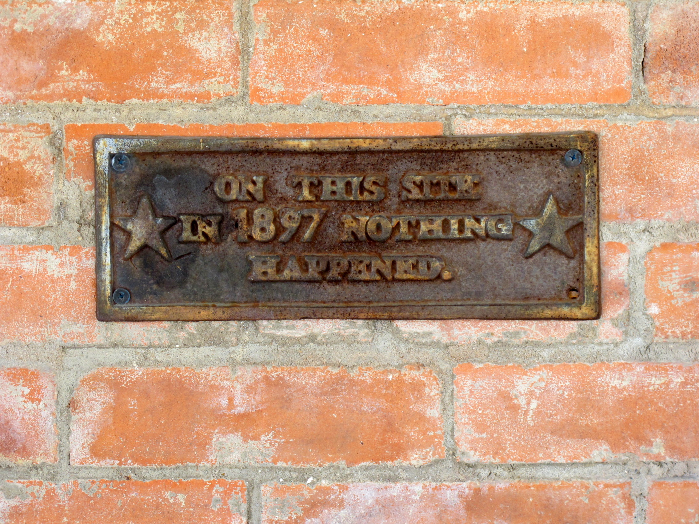
Rosebud Nothing happened

MegaDays day 3 about to commence.

Decay...
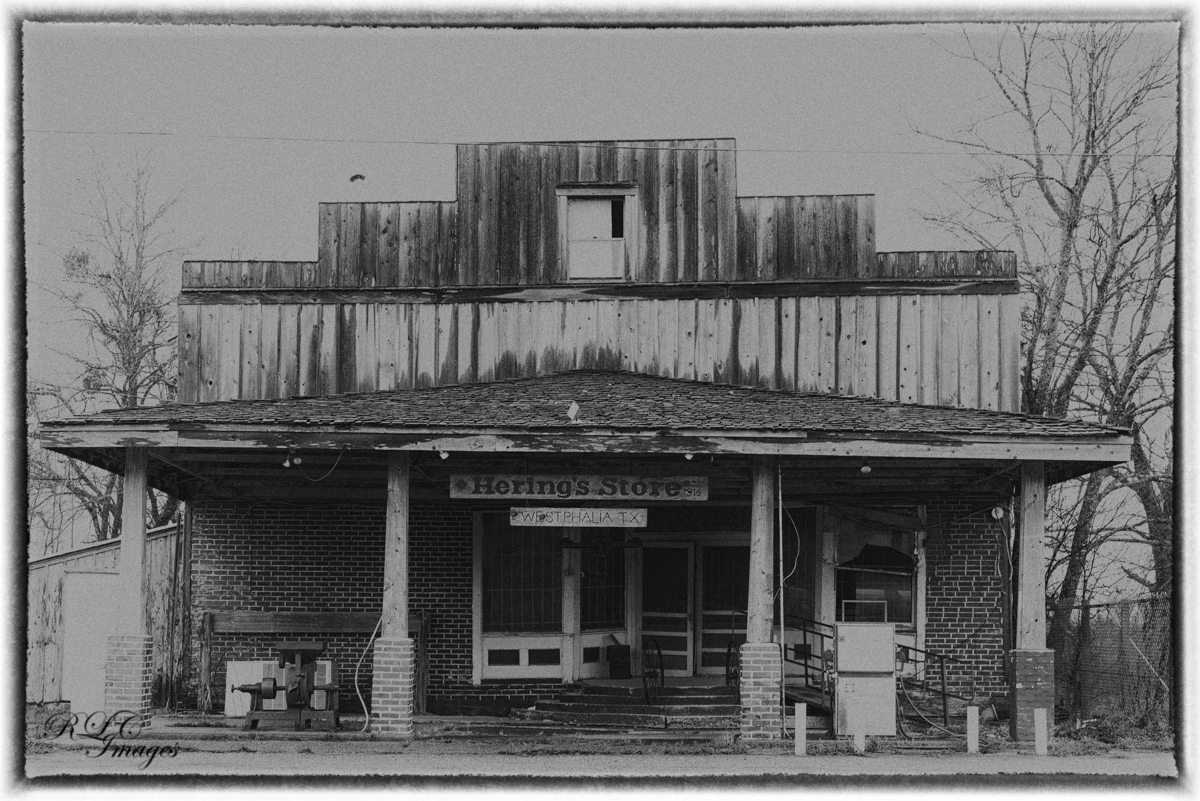
Hering's Store

Church of the Visitation

The Old Store

Rosebud, TX VFD Unit 4

Doris and Becky

Rosebud, TX VFD Retired Unit 1

Rosebud, TX VFD Retired Unit 1
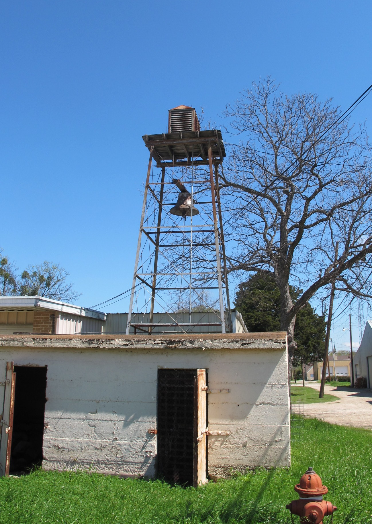
Fire Alarm in Rosebud

Visitation Catholic Church, Westphalia

Visitation Catholic Church, Westphalia

Visitation Catholic Church, Westphalia

Visitation Catholic Church, Westphalia

Visitation Catholic Church, Westphalia
Topographic Map of Falls County, TX, USA
Find elevation by address:

Places in Falls County, TX, USA:
Places near Falls County, TX, USA:
983 County Rd 402
983 County Rd 402
307 Avenue E
Rosebud
403 E Avenue A
TX-7, Chilton, TX, USA
Burlington
9406 Us-77
730 County Rd 326
Marlin
Reagan
Riesel
Bremond
County Road 148
Hwy 6, Waco, TX, USA
204 Hwy 6
Hall Dr, Waco, TX, USA
Kosse
314 W Burleson Ave
Mart
Recent Searches:
- Elevation of Corso Fratelli Cairoli, 35, Macerata MC, Italy
- Elevation of Tallevast Rd, Sarasota, FL, USA
- Elevation of 4th St E, Sonoma, CA, USA
- Elevation of Black Hollow Rd, Pennsdale, PA, USA
- Elevation of Oakland Ave, Williamsport, PA, USA
- Elevation of Pedrógão Grande, Portugal
- Elevation of Klee Dr, Martinsburg, WV, USA
- Elevation of Via Roma, Pieranica CR, Italy
- Elevation of Tavkvetili Mountain, Georgia
- Elevation of Hartfords Bluff Cir, Mt Pleasant, SC, USA