Elevation of Earnest Bridge, Paschelke Rd, Marcola, OR, USA
Location: United States > Oregon > Lane County > Marcola >
Longitude: -122.83604
Latitude: 44.2012934
Elevation: 170m / 558feet
Barometric Pressure: 99KPa
Elevation Map:
Satellite Map:
Related Photos:

More Shotgun Creek

Peaceful-Co-Existence. Image by Eva.
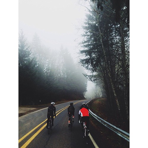
54 foggy miles on mckenzie view with the team this morning [18/365] #eugene #oregon #cycling #felt #greatnorthcollective #fog

Cross View

Horse Rock Ridge, Study 2

Horse Rock Ridge, Study 1

IMG_7233 Prairie Mountain

IMG_7228 Mary's Peak

IMG_7230 Diamond Hill Road Wetlands

IMG_7231 Diamond Hill Road Wetlands

View from the Horse Rock Ridge Trail

IMG_7232 Diamond Hill Road Wetlands

IMG_7234 Oak Basin Farm

View from the Horse Rock Ridge Trail

View from the Horse Rock Ridge Trail

OregonTrip_10-2010-4075

Jun 10th - Partial - partial view of Lower Proxy Falls #fmsphotoaday #oregonexplored

View from the Farm
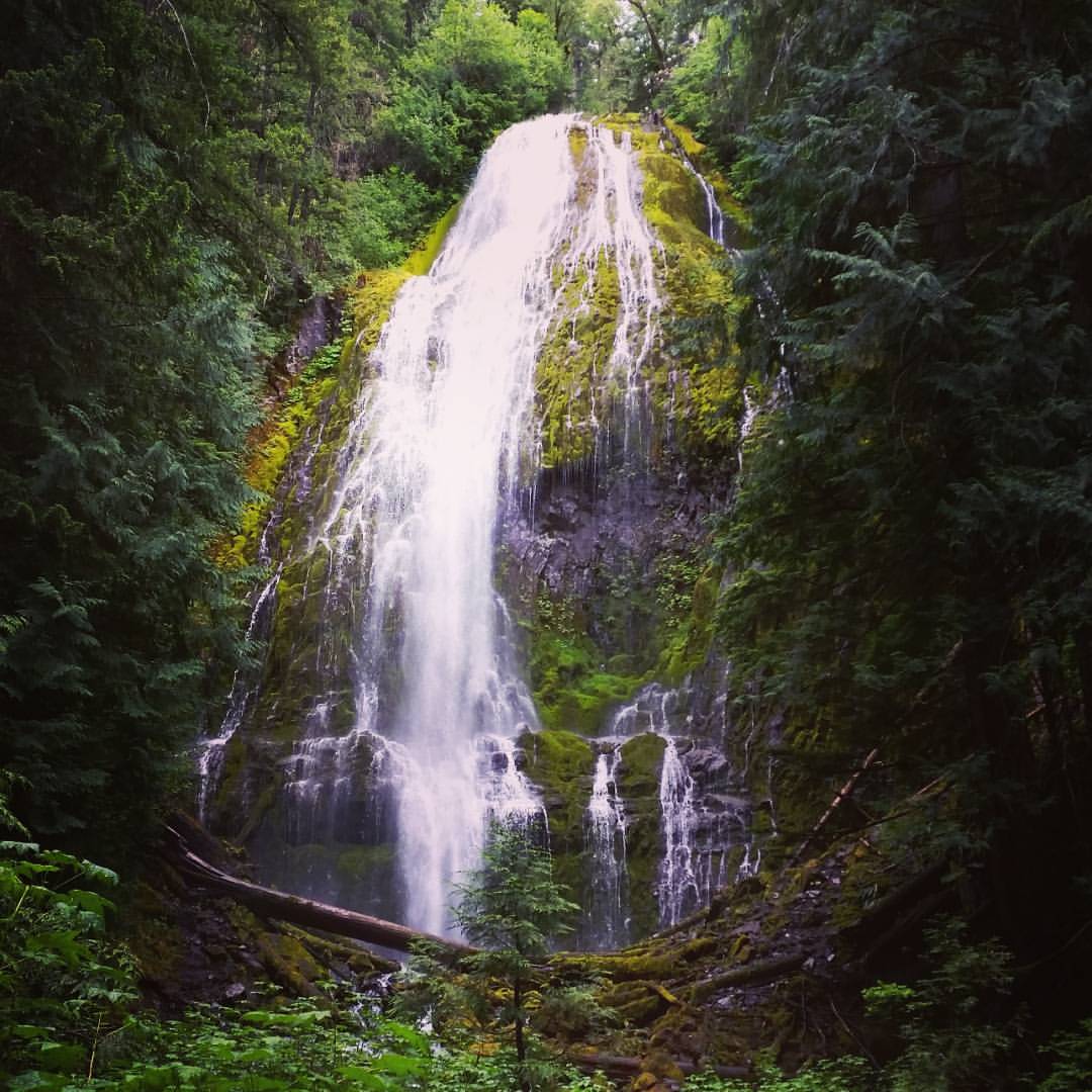
Lower Proxy Falls #oregonexplored #pnw #pnwonderland

McKenzie River

Oaks near Lebanon

Aerials: from Las Vegas to Portland. Clear skies!

Aerials: from Las Vegas to Portland. Clear skies!

Walterville Canal

IMG_7208 Coburg Hills

IMG_7207 Coburg Hills

McKenzie River, Eugene

Sunrise on my way to work
Topographic Map of Earnest Bridge, Paschelke Rd, Marcola, OR, USA
Find elevation by address:

Places near Earnest Bridge, Paschelke Rd, Marcola, OR, USA:
93000 Marcola Rd
38935 Shotgun Creek Rd
Marcola Rd, Marcola, OR, USA
Marcola
92088 Marcola Rd
92088 Marcola Rd
97448 Johnson Rd
Pioch Lane
92465 Pioch Ln
Shotgun Creek
37319 Parsons Creek Rd
Howard Road
37148 Parsons Creek Rd
40051 Mohawk River Rd
Crooked Creek Road
40237 Mohawk River Rd
37203 Conley Rd
40385 Mohawk River Rd
36731 Boiler Creek Rd
Seeley Creek Road
Recent Searches:
- Elevation of 15th Ave SE, St. Petersburg, FL, USA
- Elevation of Beall Road, Beall Rd, Florida, USA
- Elevation of Leguwa, Nepal
- Elevation of County Rd, Enterprise, AL, USA
- Elevation of Kolchuginsky District, Vladimir Oblast, Russia
- Elevation of Shustino, Vladimir Oblast, Russia
- Elevation of Lampiasi St, Sarasota, FL, USA
- Elevation of Elwyn Dr, Roanoke Rapids, NC, USA
- Elevation of Congressional Dr, Stevensville, MD, USA
- Elevation of Bellview Rd, McLean, VA, USA