Elevation of Coffeyville Area Chamber of Commerce, S Walnut St, Coffeyville, KS, USA
Location: United States > Kansas > Montgomery County > Coffeyville >
Longitude: -95.615499
Latitude: 37.035691
Elevation: 223m / 732feet
Barometric Pressure: 99KPa
Elevation Map:
Satellite Map:
Related Photos:

HDR Condon Bank side view

Utah and Travel
Memorial Hospital
Utah and Travel
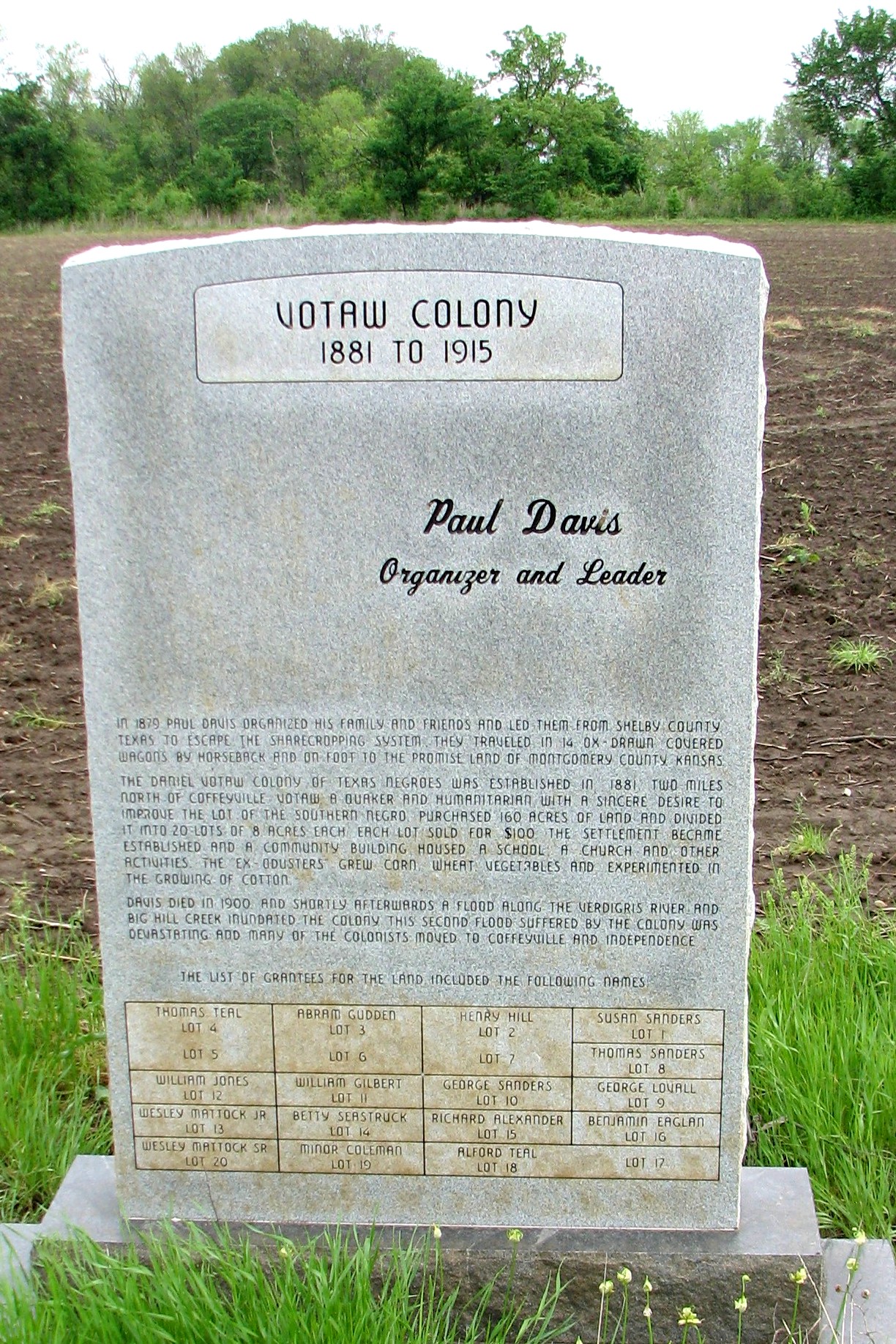
Votaw Colony

Utah and Travel
Pumpkin Creek

Valeda Kansas School

Coffeyville Kansas

Stateline Sunset

DSC_0040.JPG

horse family

Restview Cemetery

falling water in the woods

Grand Canyon

Grand Canyon
Topographic Map of Coffeyville Area Chamber of Commerce, S Walnut St, Coffeyville, KS, USA
Find elevation by address:

Places near Coffeyville Area Chamber of Commerce, S Walnut St, Coffeyville, KS, USA:
Lanning's Downtown Grill
Coffeyville Electric Light
Superior Head Services
Coffeyville
Utopia
Ross's Bbq Restaurant
Midwest Pregnancy Care Center
Mission Funeral Services
First United Methodist Church
Kfc
Mcdonald's
Fourth Street Laundry
Phelps's Hog Heaven
400 N Linden St
Hamilton Equipment Co
Riley's Truck Repair
Walmart Supercenter
Town Of South Coffeyville
South Coffeyville
Go Natural Llc
Recent Searches:
- Elevation of Fern Rd, Whitmore, CA, USA
- Elevation of 62 Abbey St, Marshfield, MA, USA
- Elevation of Fernwood, Bradenton, FL, USA
- Elevation of Felindre, Swansea SA5 7LU, UK
- Elevation of Leyte Industrial Development Estate, Isabel, Leyte, Philippines
- Elevation of W Granada St, Tampa, FL, USA
- Elevation of Pykes Down, Ivybridge PL21 0BY, UK
- Elevation of Jalan Senandin, Lutong, Miri, Sarawak, Malaysia
- Elevation of Bilohirs'k
- Elevation of 30 Oak Lawn Dr, Barkhamsted, CT, USA