Elevation of Đồng Văn District, Ha Giang, Vietnam

Location: Vietnam > Ha Giang >

Longitude: 105.242885

Latitude: 23.2246718

Elevation: 1491m / 4892feet

Barometric Pressure: 85KPa

Elevation Map:

elevation map of Đồng Văn District, Ha Giang, Vietnam

Satellite Map:

Satellite map of Đồng Văn District, Ha Giang, Vietnam

Related Photos:

vietnam hàgiangprovince mèovạcdistrict đồngvănkarstplateau landscape ql4c mãpìlèngpass
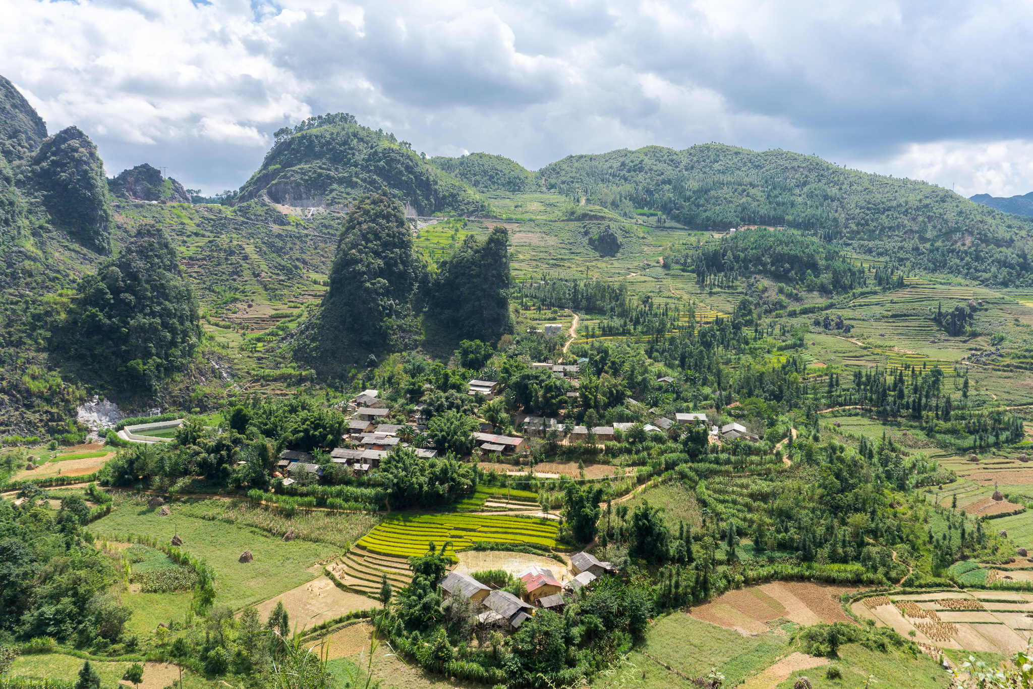
Farmhouse Among the Karst
vietnam hàgiangprovince đồngvăndistrict đồngvănkarstplateau landscape ql4c mãpìlèngpass
Sông Nho Quế (Nho Quế River) Panorama
vietnam hàgiangprovince đồngvăndistrict đồngvănkarstplateau landscape ql4c mãpìlèngpass
View Down the Sông Nho Quế (Nho Quế River)
vietnam hàgiangprovince đồngvăndistrict đồngvănkarstplateau landscape ql4c mãpìlèngpass
Sông Nho Quế (Nho Quế River) View
đồngvăn hàgiang vietnam vn landscape view city overview
-c20180916-810_0089
vietnam hàgiangprovince mèovạcdistrict đồngvănkarstplateau landscape ql4c mãpìlèngpass
Farmhouse With a View
vietnam hàgiangprovince đồngvăndistrict đồngvănkarstplateau landscape ql4c mãpìlèngpass
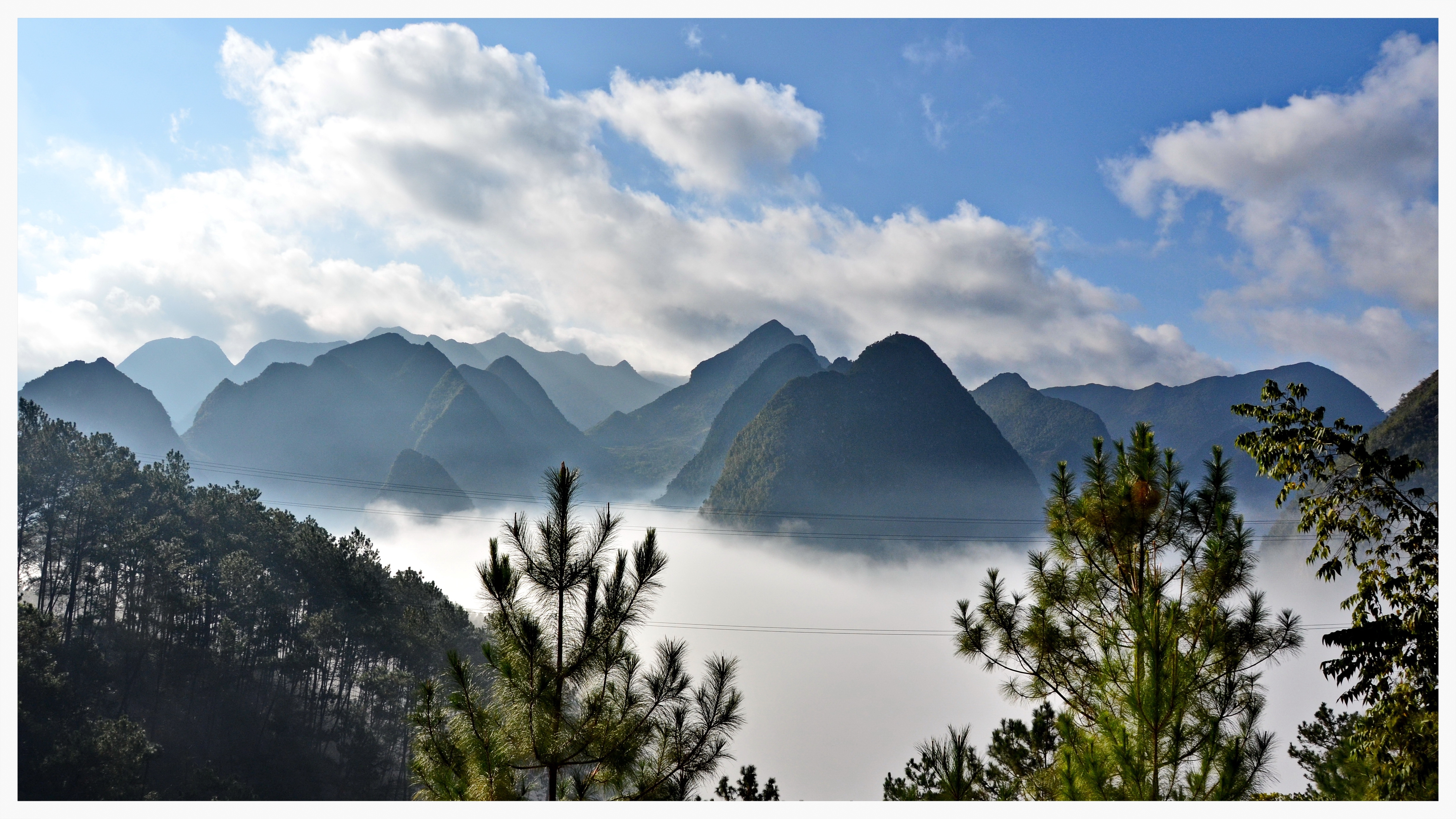
The Canyon of the Sông Nho Quế (Nho Quế River)
vietnam hàgiangprovince đồngvăndistrict đồngvănkarstplateau landscape ql4c mãpìlèngpass
Afternoon on the Sông Nho Quế (Nho Quế River)
vietnam hàgiangprovince đồngvăndistrict đồngvănkarstplateau landscape ql4c mãpìlèngpass
Morning on the Sông Nho Quế (Nho Quế River)
hagiang vietnam spring hagiangspring
Aerial view of Ha Giang
dongvan food hagiang landscape nature park seasia vietnam agriculture asia asian countryside cultivation curve dong ethnic farming field fields flickr geological giang girl global green grow ha harvest hill house houses looking lush mountain outdoor paddy plateau rice rock small terraced tourism travel tree valley van vietnamese view village yellow
Dong Van (Ha Giang),Vietnam
dongvan food hagiang landscape nature park seasia sapa vietnam agriculture asia asian countryside cultivation curve dong ethnic farming field fields flickr geological giang global green grow ha harvest hill house houses lush mountain outdoor paddy plateau rice rock small terraced terraces tourism travel tree valley van vietnamese view village yellow
Dong Van (Ha Giang),Vietnam
dongvan food hagiang landscape nature park seasia vietnam agriculture asia asian countryside cultivation curve dong ethnic farming field fields flickr geological giang global green grow ha harvest hill house houses lush mountain outdoor paddy plateau rice rock small terraced tourism travel tree valley van vietnamese view village yellow
Dong Van (Ha Giang),Vietnam
dongvan food hagiang landscape nature park seasia vietnam agriculture asia asian countryside cultivation curve dong ethnic farming field fields flickr geological giang global green grow ha harvest hill house houses lush mountain outdoor paddy plateau red rice rock small terraced tourism travel tree valley van vietnamese view village yellow
Dong Van (Ha Giang),Vietnam
dongvan food hagiang landscape nature park seasia vietnam agriculture asia asian countryside cultivation curve dong ethnic farming field fields flickr geological giang global green grow ha harvest hill house houses lush mountain outdoor paddy plateau rice rock small terraced tourism travel tree valley van vietnamese view village yellow
Dong Van (Ha Giang),Vietnam
architecture building dongvan hagiang landscape nature seasia sapa vacation vietnam asia asian beautiful blue city cityscape cloud cloudy downtown flickr forest fresh green high hill house landmark light mist misty mountain natural north plant plateau range scene sky tourism town travel tree urban valley vietnamese view village
Ha Giang, Vietnam
travel panorama mountains geotagged southeastasia rice vietnam roads karst indochina hagiang hàgiang việtnam geo:lat=2321024025959121 geo:lon=1051954753546317
Cao Phố views
mountains geotagged southeastasia vietnam indochina hagiang hàgiang geo:lat=2328091452680161 geo:lon=1053345006959336 việtnam
View of Đồng Văn
travel geotagged southeastasia vietnam hmong indochina hagiang hàgiang việtnam geo:lat=2325539986134643 geo:lon=1052623601922596
View from the turret
vietnamcycling cyclingvietnam vietnambiketours vietnambikingtours sapa tour train
View from Ma Pi Leng Pass
sủnglà hàgiang vietnam vn color landscape
-c20180916-810_9644
xàphìn hàgiang vietnam vn
-c20180916-810_9732
sủnglà hàgiang vietnam vn
-c20180916-810_9647-2
vietnam hàgiangprovince đồngvăndistrict đồngvănkarstplateau landscape sủngtrái
Sủng Trái
geotagged haze terraces hills vietnam agriculture hagiang dongvan
Dong Van
đồngvăn hàgiang vietnam vn landscape colot
-c20180916-810_9770-2-2
vietnam hàgiangprovince yênminhdistrict đồngvănkarstplateau landscape mậuduệ antimonymine
Antimony Mine at Mậu Duệ
vietnam hàgiangprovince đồngvăndistrict đồngvănkarstplateau landscape ql4c mãpìlèngpass
Headed Home on the Mã Pì Lèng Pass
málé hàgiang vietnam vn
-c20180916-810_9792-2-2
vietnam hàgiangprovince đồngvăndistrict đồngvăn đồngvănkarstplateau landscape
Sunny Afternoon in Đồng Văn
landscape sunset nature mist hanhphhucroad sky cold road sun hoanghon sunlight nui sunrise travel cloud hagiang lanh trip fog forest may happyroad mountain
Ha Giang mountains
Đồng Văn Rock Plateau
hanhphucroad sunrise sunset nature mist fog cold landscape sun road lanh nui sky travel forest hagiang hoanghon trip sunlight cloud may happyroad mountain
Into the moutains
thàiphìntủng hàgiang vietnam vn
Dong Van
phốcáo hàgiang vietnam vn road landscape loop mountain green clouds fog
The Road from Ha Giang to Dong Van